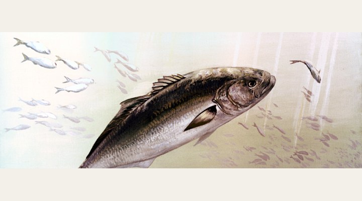
Tailor
Excellent
The main run. Fish the gutters and headlands into the evening; ganged pilchards, metals, and a wire-free trace only if you accept the bite-offs.
Updated Sat, 26 Sept 2026 from live weather and tide data
The lighthouse village between Port Stephens and Forster: Sugarloaf Point rocks, Number One and Boat beaches, and the reef and seals of the point.
Sources: modelled tide curve, Open-Meteo, solunar calculated for these coordinates.
Seal Rocks is in its cool-water rhythm: slower presentations and the warmest hours of the day. Today brings clear skies, wind NNE around 24 km/h, rising pressure near 1028 hPa and a high of 23 °C. Tides: high 7:05 am and 7:12 pm, low 12:55 am and 1:00 pm: the moving water either side of each change is when this place feeds. Water sits around 17 °C for the season (estimated). With the full moon, the solunar majors run 11:16 PM-1:16 AM and 11:16 AM-1:16 PM: the windows to build the day around.
The main run. Fish the gutters and headlands into the evening; ganged pilchards, metals, and a wire-free trace only if you accept the bite-offs.
The main season. Beach gutters, rock platforms and bay edges on the rising tide; metals, surf poppers and bait all work.
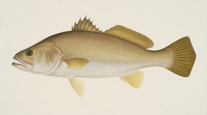
The estuary fish move to the deeper reaches. Long, quiet sessions on the bottom with fresh bait across the top of the tide.
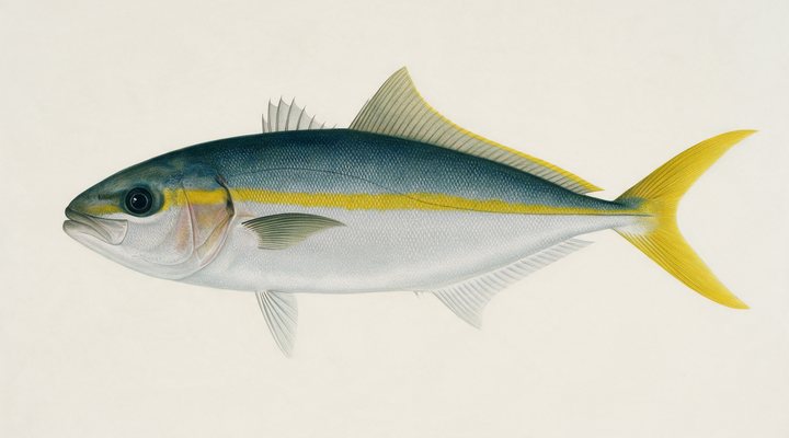
The fish thin out as the current cools; jig the deeper offshore marks and work the harbours on the warmer afternoons.
Tie on: Blade or vibe, slow hops · Lightly weighted plastic · Whole pilchard or squid on the bottom · Suspending hardbody. Prime windows: 11:16 PM-1:16 AM, 11:16 AM-1:16 PM, 5:46 AM-6:46 AM. Cooler at 19 °C with likely rain: fish ahead of the front. The solunar majors shift about 50 minutes later.
New South Wales requires a fishing licence for most fishing, from A$7.00. New South Wales fishing licence: cost, rules and where to buy →
Chasing tailor here? Check the size and bag limits with DPIRD NSW before you keep anything; the Tailor page has the seasons and the tactics.
Hour-by-hour bite forecast for today from sunrise (05:35), sunset (17:48), the moon and today's score, with the modelled tide changes in the panel below. Tap a bar to see why.
Solunar majors 11:16 PM-1:16 AM and 11:16 AM-1:16 PM; minor 5:46 AM-6:46 AM. Full Moon, 100% lit.
A modelled tide curve for these coordinates and the forecast for the day.
Modelled sea level curve from Open-Meteo Marine for these coordinates, datum mean sea level. Fish the moving water either side of each change.
A model, not the official prediction: times can drift by tens of minutes inside bays and estuaries. Check the Bureau of Meteorology tide predictions for the exact times before you rely on them.
Latest readings
Why the tide matters here: tides and fishing in Australia.
The best day on Seal Rocks this week looks like Tuesday 29 Sept, at 4 out of 5, against 2 today. Every day is scored by the same engine as the report above: pressure trend first, then wind, sky and season. Pick a species and the plan for that day changes with it.
Best day this week: Tuesday, 29 Sept — good at 4/5, falling pressure, usually the best window of a week.
Conditions favor short windows and patient fishing.
Scores are a planning aid built from forecast data, not a promise.
The species that matter on Seal Rocks: seasons written for the southern year, and how to fish each one. Today's ratings live in the report above.
The surf and rock fish of the east coast, running north in autumn and winter. Fast, toothy and best at dawn, dusk and into the dark. The main run. Fish the gutters and headlands into the evening; ganged pilchards, metals, and a wire-free trace only if you accept the bite-offs.
Jewfish. The big silver prize of the estuaries, breakwalls and surf beaches: nocturnal, tide-driven and unforgiving of noise. The estuary fish move to the deeper reaches. Long, quiet sessions on the bottom with fresh bait across the top of the tide.
The hardest-pulling fish within reach of the shore. Headlands, harbour markers, offshore reefs and the warm current in summer. The fish thin out as the current cools; jig the deeper offshore marks and work the harbours on the warmer afternoons.
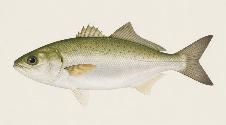
Not a salmon at all: a hard-fighting schooling fish of the surf and the bays, from WA around to NSW. Great on light gear, poor on the plate. The main season. Beach gutters, rock platforms and bay edges on the rising tide; metals, surf poppers and bait all work.
Activity by species and month for the southern year, and how the water warms and cools. Tap any cell.
1 = slow, 5 = peak. Current month highlighted. January is midsummer here.
Typical surface temperature for this water type in degrees Celsius; today is around 17 °C (estimated, not a reading).
Real reports from real anglers, reviewed before publishing. Nothing here is copied from a shop or a charter. The water log below tracks each day automatically.
3/5 Fair. Fish the windows. A steady pattern: dawn and dusk carry the day. Tailor led the card at excellent. High of 22 °C, wind to 29 km/h.
3/5 Fair. Fish the windows. A steady pattern: dawn and dusk carry the day. Tailor led the card at excellent. High of 21 °C, wind to 32 km/h.
3/5 Fair. Fish the windows. A steady pattern: dawn and dusk carry the day. Tailor led the card at excellent. High of 20 °C, wind to 34 km/h.
NSW Recreational Fishing Fee, from A$7.00, the same for residents and visitors. Details and where to buy →
Size and bag limits, closed seasons and marine park zones are set by DPIRD NSW and change: confirm the current rules on the agency page linked from the New South Wales licence page before you keep anything.
Fishing Seal Rocks takes the NSW Recreational Fishing Fee, A$7 for three days at the cheapest; the New South Wales licence page on this site has the rest.
Seal Rocks is a coastal town in New South Wales, Australia, covered from the New South Wales reports and listed in all Australia waters.
Seal Rocks is the tiny village under Sugarloaf Point lighthouse on the mid north coast between Port Stephens and Forster, at the end of a gravel road through Myall Lakes National Park, with Number One Beach and Boat Beach either side of the point, the rock platforms of the headland, the seal colony on the rocks offshore and the camping ground behind the beach. It is a rocks-and-beach village with no estuary, and the report on this page is scored for the village’s coordinates.
Tailor and salmon run the beaches and the point in the cooler months at dawn and dusk; drummer, luderick and bream hold on the Sugarloaf platforms, the luderick and drummer in winter; whiting fish Number One Beach in summer; mulloway are the night fish of the beach gutters; kingfish, bonito and the pelagics come to the point and the reef in summer; and the reef off the point gives snapper for the boats launched off Boat Beach. The seals are protected and the grey nurse sharks of the point are the reason for the marine park’s sanctuary zone there.
Number One Beach in front of the camping ground and the gutters of Boat Beach are the tailor and whiting water, and the Sugarloaf platforms under the lighthouse are the drummer and luderick rocks, reached by the lighthouse track and fished on a westerly; Treachery Beach to the south is the jew beach at night. Boats are launched off Boat Beach for the reef off the point.
The point faces the ocean in every direction and the wind row and the swell decide the platforms: a southerly closes the southern side, a nor’-easter the northern, and a westerly opens both. The tide panel is a modelled curve for the coordinates of Seal Rocks, labelled as a model. Pressure and sky build the score at Seal Rocks; the planner shows the day. Rock fishing at Sugarloaf is exposed and the life-jacket rule applies.
Fishing Seal Rocks takes the NSW Recreational Fishing Fee, A$7 for three days at the cheapest; the New South Wales licence page on this site has the rest. The beaches, the point and the camping ground are public under the national park’s rules; the Port Stephens-Great Lakes Marine Park zoning, with a sanctuary zone at the point, and the DPIRD limits are in the sources.
On the platforms outside the marine park’s sanctuary zone, which protects the grey nurse sharks off the point; the zoning map is linked in the sources and the life-jacket rule applies.
Yes: the NSW Recreational Fishing Fee, from A$7 for three days.
Check the daily report at the top of this page: it is regenerated every morning from live data. Today's read: Slow. Work for them. Conditions favor short windows and patient fishing.
 Pablo Ruiz Quintero
Readings refresh on a 30-minute window. The full method, with every figure and its source, is on How our reports are made. Something wrong here? Tell us and it goes in the log with the date.