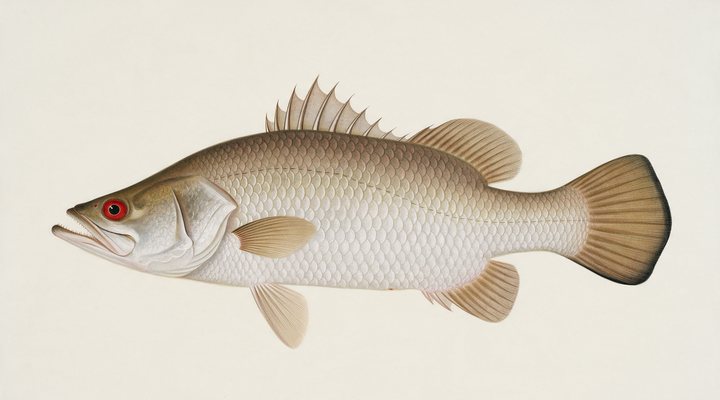
Barramundi
Good
Work the colour changes and the snags on the run-out; larger swimbaits and slow-rolled plastics in the impoundments.
Updated Sat, 26 Sept 2026 from live weather and tide data
Shady Camp on the Mary River: the Territory’s most famous barramundi spot, where the fresh meets the salt at the barrage, with no gauge and every crocodile in the north.
Sources: Open-Meteo, solunar calculated for these coordinates.
Mary River at Shady Camp has the water in the comfortable band where most of its fish feed through the day. Today brings clear skies, wind NW around 2 km/h, falling pressure near 1016 hPa and a high of 34 °C. Water sits around 26 °C for the season (estimated). With the full moon, the solunar majors run 11:16 PM-1:16 AM and 11:16 AM-1:16 PM: the windows to build the day around.
Work the colour changes and the snags on the run-out; larger swimbaits and slow-rolled plastics in the impoundments.
Tie on: Soft plastic on a 1/4 oz jighead · Small hardbody, shallow diver · Squid jig, size 3.0 · Fresh pipi or worm on a small hook. Prime windows: 11:16 PM-1:16 AM, 11:16 AM-1:16 PM, 5:46 AM-6:46 AM. Similar at 34 °C. The solunar majors shift about 50 minutes later.
Northern Territory has no general fishing licence, but rules and permits apply. Northern Territory fishing licence: cost, rules and where to buy →
Chasing barramundi here? Check the size and bag limits with NT Fisheries before you keep anything; the Barramundi page has the seasons and the tactics.
Hour-by-hour bite forecast for today from sunrise (06:30), sunset (18:39), the moon and today's score. Tap a bar to see why.
Solunar majors 11:16 PM-1:16 AM and 11:16 AM-1:16 PM; minor 5:46 AM-6:46 AM. Full Moon, 100% lit.
Conditions here are modelled from weather, season and the nearest stations.
Water readings appear when a Bureau of Meteorology station covers it. Until then the seasonal curve below is the estimate.
Latest readings
The best day on Mary River at Shady Camp this week looks like Sunday 27 Sept, at 5 out of 5, against 4 today. Every day is scored by the same engine as the report above: pressure trend first, then wind, sky and season. Pick a species and the plan for that day changes with it.
Best day this week: Sunday, 27 Sept — excellent at 5/5, falling pressure, usually the best window of a week.
Stable-to-falling pressure and workable wind line things up.
Scores are a planning aid built from forecast data, not a promise.
The species that matter on Mary River at Shady Camp: seasons written for the southern year, and how to fish each one. Today's ratings live in the report above.
The north's fish. Tidal rivers, run-off creeks, rock bars and the stocked impoundments. Warm water, moving water and a barometer on the way down. Work the colour changes and the snags on the run-out; larger swimbaits and slow-rolled plastics in the impoundments.
Activity by species and month for the southern year, and how the water warms and cools. Tap any cell.
1 = slow, 5 = peak. Current month highlighted. January is midsummer here.
Typical surface temperature for this water type in degrees Celsius; today is around 26 °C (estimated, not a reading).
Real reports from real anglers, reviewed before publishing. Nothing here is copied from a shop or a charter. The water log below tracks each day automatically.
5/5 Excellent. Go now. Everything lines up: pressure, wind and light are in your favor. Barramundi led the card at good. High of 37 °C, wind to 18 km/h.
5/5 Excellent. Go now. Everything lines up: pressure, wind and light are in your favor. Barramundi led the card at good. High of 37 °C, wind to 16 km/h.
5/5 Excellent. Go now. Everything lines up: pressure, wind and light are in your favor. Barramundi led the card at good. High of 36 °C, wind to 16 km/h.
Northern Territory has no general recreational fishing licence; the limits and closures do. Details and where to buy →
Size and bag limits, closed seasons and marine park zones are set by NT Fisheries and change: confirm the current rules on the agency page linked from the Northern Territory licence page before you keep anything.
The Northern Territory has no fishing licence; the barramundi possession limit, the closed areas and the Mary River’s specific rules apply, on the NT Fisheries page linked below.
Mary River at Shady Camp is a river in Northern Territory, Australia, covered from the Northern Territory reports and listed in all Australia waters.
Shady Camp is the barrage on the Mary River east of Darwin where the freshwater floodplain meets the tidal river, a concrete wall with a boat ramp on each side, a camping area and a fishery that has made it the best-known barramundi spot in the Northern Territory: the salt side below the barrage, the fresh side above it, and the run-off from March to May when the floodplain drains through. No level series is published for the Mary at Shady Camp, and this page says so rather than borrowing a gauge; the Bureau stations there record rainfall only.
Barramundi are the fish, on the salt side at the change of the tide and on the fresh side along the lily edges and the timber, at their best on the run-off from March to May and on the build-up from October; the Territory has no closed season for barramundi but a possession limit and closed areas that NT Fisheries publishes. Threadfin salmon and black jew are on the salt side; saratoga and sooty grunter on the fresh; and the saltwater crocodiles of Shady Camp are the densest population anywhere, which the signs and the guides say in plain words.
The salt-side ramp launches onto the tidal river toward the mouth, the fresh-side ramp onto the floodplain reaches, and the barrage wall itself is fished from the bank on the salt side at the tide change with the crocodiles a few metres away; the guides who work Shady Camp fish the tide from a boat. The road in from the Arnhem Highway is sealed to the camp and closed in the wet.
The tide panel is a modelled curve for these coordinates, labelled as a model, and the salt side fishes on the change; the rain row shows the wet arriving and the run-off that follows it, which the water authority’s floodplain gauges track and this page does not. The water temperature estimate, labelled as one, gives a long barramundi band; pressure counts before a storm.
The Northern Territory has no fishing licence; the barramundi possession limit, the closed areas and the Mary River’s specific rules apply, on the NT Fisheries page linked below. The ramps and the camping area are public under the parks service’s rules; the road closes in the wet.
No. The Bureau of Meteorology stations at Shady Camp record rainfall only, so this page shows no level and says so; the tide panel is a modelled curve for the salt side.
The run-off from March to May, as the floodplain drains through the barrage, and the build-up from October; the salt side fishes on the tide change year-round.
No. The Northern Territory has no recreational fishing licence; the barramundi possession limit and the Mary River rules apply.
Check the daily report at the top of this page: it is regenerated every morning from live data. Today's read: Good. Solid day ahead. Stable-to-falling pressure and workable wind line things up.
 Pablo Ruiz Quintero
Readings refresh on a 30-minute window. The full method, with every figure and its source, is on How our reports are made. Something wrong here? Tell us and it goes in the log with the date.