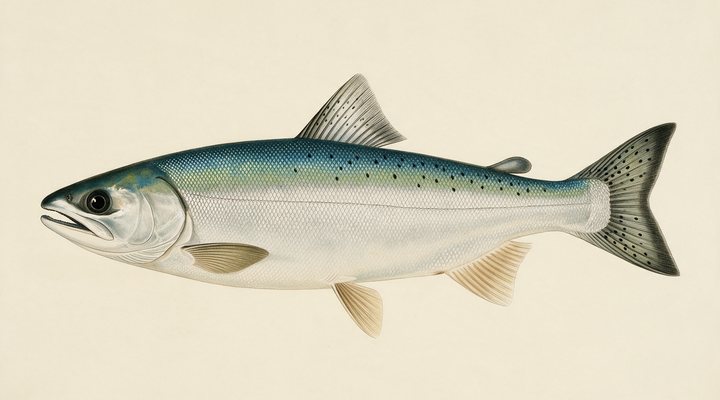
Coho salmon
Excellent
The river run. Float gear with roe or a jig, or cast spinners and spoons in the slower tailouts after a rise in water.
Updated Fri, Sep 25, 2026 from live weather and water data
Ucluelet on the Pacific Rim: chinook, coho and halibut off the open coast and Barkley Sound, from the town beside the national park.
Sources: modelled tide curve, Open-Meteo, solunar calculated for these coordinates.
Ucluelet rewards patience today, with cool water and short feeding windows. Today brings cloud cover, wind NNW around 8 km/h, rising pressure near 1005 hPa and a high of 14 °C. Tides: high 12:02 p.m., low 5:47 a.m. and 6:10 p.m.: the moving water either side of each change is when this place feeds. Water sits around 13 °C for the season (estimated). With the full moon, the solunar majors run 10:25 AM-12:25 PM and 10:25 PM-12:25 AM: the windows to build the day around.
The river run. Float gear with roe or a jig, or cast spinners and spoons in the slower tailouts after a rise in water.
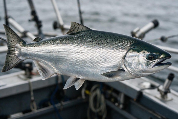
Fish are staging or moving to the rivers. On the coast, the deeper banks and the winter feeders; in Great Lakes rivers, drifted roe and spinners in the deeper runs.
Tie on: Float and roe · Swung fly through the tailout · Jerkbait, long pauses · Hair jig on the rock. Prime windows: 10:25 AM-12:25 PM, 10:25 PM-12:25 AM, 4:55 AM-5:55 AM. Similar at 16 °C. The solunar majors shift about 50 minutes later.
British Columbia requires a fishing licence for most fishing, from C$11.43. British Columbia fishing licence: cost, rules and where to buy →
Chasing chinook (spring) salmon here? Check the size and bag limits with BC Freshwater Fishing before you keep anything; the Chinook (spring) salmon page has the seasons and the tactics.
Hour-by-hour bite forecast for today from sunrise (07:13), sunset (19:13), the moon and today's score, with the modelled tide changes in the panel below. Tap a bar to see why.
Solunar majors 10:25 AM-12:25 PM and 10:25 PM-12:25 AM; minor 4:55 AM-5:55 AM. Full Moon, 99% lit.
A modelled tide curve for these coordinates and the forecast for the day.
Modelled sea level curve from Open-Meteo Marine for these coordinates, datum mean sea level. Fish the moving water either side of each change.
A model, not the official prediction: times can drift by tens of minutes inside bays and estuaries. Check the Canadian Hydrographic Service predictions at tides.gc.ca for the exact times before you rely on them.
Latest readings
The best day on Ucluelet this week looks like Sunday Sep 27, at 4 out of 5, against 3 today. Every day is scored by the same engine as the report above: pressure trend first, then wind, sky and season. Pick a species and the plan for that day changes with it.
Best day this week: Sunday, Sep 27 — good at 4/5, falling pressure, usually the best window of a week.
A steady pattern: dawn and dusk carry the day.
Scores are a planning aid built from forecast data, not a promise.
The species that matter on Ucluelet: seasons written for the Canadian year, and how to fish each one. Today's ratings live in the report above.
The biggest Pacific salmon, called spring or king on the BC coast. Feeds along the kelp lines, points and tide rips of the BC coast before running rivers in late summer; introduced to the Great Lakes, where it runs the tributaries in fall. Retention on the BC coast changes by area and by DFO fishery notice. Fish are staging or moving to the rivers. On the coast, the deeper banks and the winter feeders; in Great Lakes rivers, drifted roe and spinners in the deeper runs.
Silver, aggressive and surface-oriented. Feeds hard along the BC coast through summer and runs the Fraser Valley and Island rivers in fall, the Vedder and the Stamp among them. Hatchery coho are marked by a clipped adipose fin; what may be kept depends on the water and the DFO notice. The river run. Float gear with roe or a jig, or cast spinners and spoons in the slower tailouts after a rise in water.
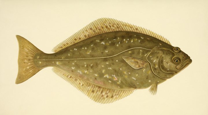
The big flatfish of the outer coast: Bamfield, Ucluelet, Tofino, Nootka and the north coast. Annual and daily limits and size rules are set by DFO and change during the season. Fewer fish; the offshore banks on the calm days.
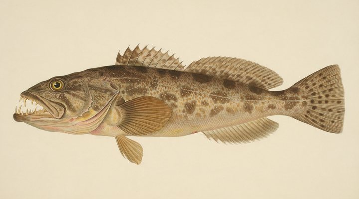
The toothy reef fish of the BC coast, on rock piles and pinnacles. Limits and closures vary by DFO management area. Fish move shallower; jig the rocky points.
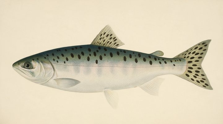
The smallest and most numerous Pacific salmon. In the south of BC the big runs come in odd-numbered years; the fish crowd the estuaries and the lower rivers in August and September. The run is over.
Activity by species and month for the Canadian year, and how the water warms and cools. Tap any cell.
1 = slow, 5 = peak. Current month highlighted. January is midsummer here.
Typical surface temperature for this water type in degrees Celsius; today is around 13 °C (estimated, not a reading).
Real reports from real anglers, reviewed before publishing. Nothing here is copied from a shop or a charter. The water log below tracks each day automatically.
3/5 Fair. Fish the windows. A steady pattern: dawn and dusk carry the day. Coho salmon led the card at excellent. High of 14 °C, wind to 10 km/h.
3/5 Fair. Fish the windows. A steady pattern: dawn and dusk carry the day. Coho salmon led the card at excellent. High of 17 °C, wind to 18 km/h.
3/5 Fair. Fish the windows. A steady pattern: dawn and dusk carry the day. Coho salmon led the card at excellent. High of 17 °C, wind to 18 km/h.
BC freshwater fishing licence, from C$11.43 for a resident adult, with higher prices for other Canadians and visitors. Details and where to buy →
Size and bag limits, closed seasons and protected areas are set by BC Freshwater Fishing and, in salt water and for salmon, by Fisheries and Oceans Canada, and change: confirm the current rules on the agency page linked from the British Columbia licence page before you keep anything.
Salt water needs the DFO tidal licence and the salmon conservation stamp; halibut must be recorded as the licence requires.
Ucluelet is a coastal town in British Columbia, Canada, covered from the British Columbia reports and listed in all Canada waters.
Ucluelet is the fishing town on the west side of Barkley Sound, on a peninsula facing the open Pacific next to the Pacific Rim National Park Reserve, with Tofino forty minutes up the road. Its harbour is a working one, and its sport fishing reaches the banks offshore and the edges of the sound. The report on this page is scored for the town, with a modelled tide curve.
Chinook and coho feed along the outer coast from early summer, and halibut, lingcod and rockfish are fished on the offshore banks and reefs. DFO sets the rules by area and changes them by notice through the season.
Charters and private boats run offshore to the banks on calm days and fish the outer edges of Barkley Sound when the swell is up. From shore, the rocky coast along the Wild Pacific Trail is scenic but exposed; waves on this coast can be dangerous. The edges of the Broken Group and the waters off Amphitrite Point are the transition between the sheltered sound and the open coast, and the tide lines there hold bait and salmon.
Ucluelet is reached on Highway 4 from Port Alberni, a winding mountain road. The town has lodges, marinas and charter operators; the national park next door has its own campgrounds and rules.
The salmon and halibut season runs through summer; winter brings storms that people come to watch rather than fish. Early summer brings the first chinook along the outside, midsummer the coho and the best halibut weather, and late summer the salmon that turn into Barkley Sound for the Alberni Inlet.
The tide panel shows a modelled curve, labelled as a model; the official predictions are the Canadian Hydrographic Service’s. The swell and the wind decide whether the boats go out; pressure and sky build the score.
Salt water needs the DFO tidal licence and the salmon conservation stamp; halibut must be recorded as the licence requires. Area limits are on the DFO pages linked below.
Chinook and coho in summer, and halibut, lingcod and rockfish offshore, fished by charter or private boat.
About forty minutes by road, on the same peninsula of the Pacific Rim.
In places, but the open coast is exposed and waves can be dangerous; most fishing here is from boats.
Check the daily report at the top of this page: it is regenerated every morning from live data. Today's read: Fair. Fish the windows. A steady pattern: dawn and dusk carry the day.
 Pablo Ruiz Quintero
Readings refresh on a 30-minute window. The full method, with every figure and its source, is on How our reports are made. Something wrong here? Tell us and it goes in the log with the date.