Toms River Fishing Report

Updated Mon, Nov 9, 2026 from live gauge and weather data

An Ocean County river with spring trout stocking and a year-round Trout Conservation Area below Riverwood Park.

3/5
Fair. Fish the windows.A steady pattern: dawn and dusk carry the day.
Next tide
Low 5:40 PM
Air / High
46 / 56 F
Wind
WSW 8 mph

Sources: USGS gauge 01408500, NOAA tides 8533051, Open-Meteo, solunar calculated for these coordinates.

Satellite view
Monday
9
November 2026

Today's Fishing Report

Generated this morning from live readings: gauge, weather model, sun and moon. A fresh report is published here every morning.

3/5Fair. Fish the windows.A steady pattern: dawn and dusk carry the day.

Toms River feels the season turning: shorter days, grouping fish. The river is running 382 cfs, on the rise. Today brings clear skies, wind WSW around 8 mph, steady pressure near 1011 hPa and a high of 56. Tides: high 11:11 AM and 10:59 PM, low 4:53 AM and 5:40 PM: the moving water either side of each change is when this place feeds. Water sits around 63 F for the season (estimated). With the new moon, the solunar majors run 11:21 PM-1:21 AM and 10:57 AM-12:57 PM: the windows to build the day around.

The plan, species by species
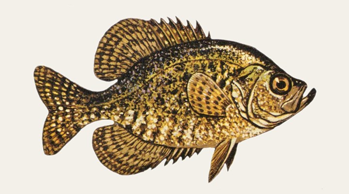
CrappieGood

Pre-spawn fish move toward shallow coves, and Iowa DNR points to wading as an effective way to reach them in spring; minnows or small jigs under a float.
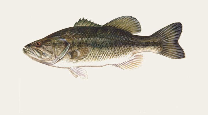
Largemouth bassFair

In spring, pre-spawn bass push shallow as the water climbs through the mid-50s; in fall they feed actively until the water cools into the low 50s, then drop back toward deeper structure.
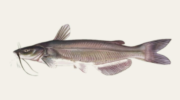
Catfish (blue, channel)Fair

In spring after ice-out, Iowa finds channel cats feeding on winter-killed shad on the shallow, warmer mudflats at the upper ends of reservoirs; cut bait on the bottom works there.
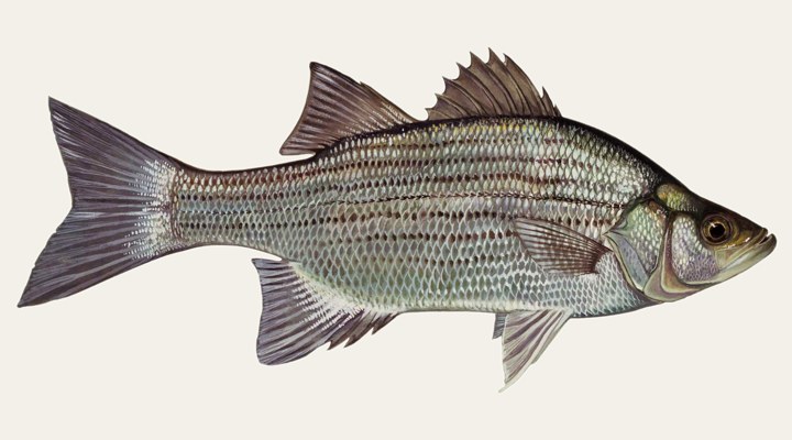
White bassSlow

The spring run happens in this band: tributaries, shoals and the upper ends of reservoirs as the water reaches about 55°F.

Tomorrow: Similar at 60 F. The solunar majors shift about 50 minutes later.Next report: Tue, Nov 10, 6:30 AMHow this report is made →

Water and weather

Live readings from Toms River near Toms River NJ.

Flow, last 30 days

USGS gauge 01408500.

146239332382 cfs10/1010/2010/3011/09

Today’s flow against 98 years of November 9

At 382 cfs, the flow at USGS gauge 01408500 (Toms River near Toms River NJ) is above the 95th percentile for the date: much above normal. In half of the 98 years of approved record the daily mean on November 9 was below 165 cfs; the highest was 1,640 cfs and the lowest 63 cfs.

p10 103median 165p90 314

Percentiles of the daily mean flow for this date, from the USGS Water Data Statistics API for gauge 01408500; today’s reading is the latest instantaneous value. Classes follow the ones the USGS used on its WaterWatch maps (retired at the end of 2025): below 10th, much below normal; 10th–24th, below; 25th–75th, normal; 76th–90th, above; over 90th, much above.

Right now

Latest readings

Air temp46 F
High / Low56 / 41 F
WindWSW 8-19 mph
Pressure1010.7 hPa, steady
Sky / Rain6% cloud, 4%
Sunrise / Sunset06:35 / 16:45
MoonNew Moon, 0%
Water temp (seasonal)~63 F est.

Bite planner

Hour-by-hour bite forecast for today. Tap a bar to see why.

5 AM8 AM11 AM2 PM5 PM8 PMsunrisesunsetPRIMEPRIME

Which day to fish Toms River this week

The best day on Toms River this week looks like Saturday Nov 14, at 4 out of 5, against 3 today.

Best day this week: Saturday, Nov 14 — good at 4/5, falling pressure, usually the best window of a week.

Today, Nov 9 — Fair

A steady pattern: dawn and dusk carry the day.

Solunar majors
11:21 PM-1:21 AM and 10:57 AM-12:57 PM
Minor period
6:44 AM-7:44 AM
Sun
06:35 to 16:45
Moon
New Moon, 0% lit
Sky and wind
Showers, 16 mph
Rain chance
4%

Forecast-based scores, less reliable further out: how the score is built.

Species guide

The species that matter on Toms River: seasons, structure and how to fish each one. Today's ratings live in the report above.

Largemouth bass illustration

Largemouth bass

Best: the spring pre-spawn and the fall feed

A warm-water sunfish of lakes, reservoirs, ponds and slow river backwaters that holds tight to cover: weeds, logs, rock ledges and docks. In Texas, TPWD surveys rank it "by far" the freshwater fish anglers most want to catch. In spring, pre-spawn bass push shallow as the water climbs through the mid-50s; in fall they feed actively until the water cools into the low 50s, then drop back toward deeper structure.

Crappie illustration

Crappie

Best: the spring spawn; summer around docks, brush and the thermocline

Two slab-sided panfish, the white crappie and the black crappie, that gather around submerged timber, brush piles, docks and bridge pilings in lakes, reservoirs and slow river backwaters. Texas Parks and Wildlife counts crappie as the state's most popular panfish. Pre-spawn fish move toward shallow coves, and Iowa DNR points to wading as an effective way to reach them in spring; minnows or small jigs under a float.

Catfish (blue, channel) illustration

Catfish (blue, channel)

Year-round, best at dusk and after dark

Three big catfish share most of the country's rivers and reservoirs: the channel catfish, the most widespread; the blue catfish, the largest; and the flathead, which hunts live fish. All feed mostly on or near the bottom. In spring after ice-out, Iowa finds channel cats feeding on winter-killed shad on the shallow, warmer mudflats at the upper ends of reservoirs; cut bait on the bottom works there.

White bass illustration

White bass

Best: the spring run up the tributaries, then summer surface schools

A silvery temperate bass of rivers and large reservoirs, also called sand bass, that schools in open water after shad and runs up tributaries to spawn in early spring. The spring run happens in this band: tributaries, shoals and the upper ends of reservoirs as the water reaches about 55°F.

When to come: the Toms River calendar

Activity by species and month, and how the water warms through the year. Tap any cell.

Species activity by month

1 = slow, 5 = peak. Current month highlighted.

J
F
M
A
M
J
J
A
S
O
N
D
Largemouth bass
Crappie
Catfish (blue, channel)
White bass
SlowPeak

Water temperature through the year

Typical surface temperature for this water type; today is around 63 F (estimated, not a reading).

5060708090JanMarMayJulSepNovNov, ~63 F now

Angler reports

Real reports from real anglers, reviewed before publishing. The water log below tracks each day automatically.

No angler reports yet this weekBe the first: your report helps every angler who checks Toms River today, and we feature the best catch of the week.

Water log, last days

Auto-logged from live data
Sun, Nov 8

3/5 Fair. Fish the windows. A steady pattern: dawn and dusk carry the day. Crappie led the card at good. High of 58 F, wind to 14 mph.

Sat, Nov 7

3/5 Fair. Fish the windows. A steady pattern: dawn and dusk carry the day. Crappie led the card at good. High of 59 F, wind to 15 mph.

Fri, Nov 6

3/5 Fair. Fish the windows. A steady pattern: dawn and dusk carry the day. Crappie led the card at good. High of 69 F, wind to 10 mph.

Where roughly, what depth, what bait. Skip anything you want to keep secret.
Only used if we need to ask you about your report. No mailing list, no spam.

Before you go

License

New Jersey requires a valid fishing license for adults. Buy online from the state agency; one-day options exist for visitors.

Regulations

New Jersey fishing license and trout stamp to fish for or keep trout (16 and older; residents 70 and over exempt), required at and above the Garden State Parkway northbound bridge. Trout Conservation Area: lures and flies only, 1 trout at 15 inches, catch-and-release March 23–April 11. Below the bridge, check NJDEP's marine rules.

Access

Riverwood Park in Toms River Township at the head of the Trout Conservation Area; stocked water from Route 528 in Jackson and between Route 70 and Route 571.

About this water

A river in Ocean County, New Jersey, flowing to Barnegat Bay; USGS gauge 01408500 near Toms River reports flow, and NOAA tide station 8533051 sits at the town.

Fishing Toms River: the full guide

Stocked trout water

New Jersey stocks trout in two reaches of the Toms River: from Route 528 in Jackson Township down to the confluence with Maple Root Branch, and from Route 70 to Route 571 in Toms River and Manchester townships. During the spring stocking period those reaches close from 5 a.m. to 5 p.m. on the published stocking Mondays.

The Trout Conservation Area

From the end of Riverwood Park in Toms River Township downstream about a mile to the Route 571 bridge, the river is a year-round Trout Conservation Area. Only artificial lures and flies may be used, the limit is 1 trout a day at 15 inches or longer, and fishing is catch-and-release only from March 23 to April 11.

Trout limits elsewhere

Outside the conservation area New Jersey's stream trout rules apply: a 9-inch minimum and a daily limit that changes through the year. For 2026 it is 2 trout from January 1 to March 22, 6 from opening day on April 11 to May 31, and 2 from June through December.

Where fresh water ends

New Jersey's freshwater license line on the Toms River is the northbound Garden State Parkway bridge; a license is needed at and above it. Below, the river is tidal: NOAA keeps a tide station at the town of Toms River.

Common questions

Where is the Trout Conservation Area?

From the end of Riverwood Park in Toms River Township downstream to the Route 571 bridge, about a mile. It is open all year to artificial lures and flies only.

When is the river closed for stocking?

In spring, from 5 a.m. to 5 p.m. on the stocking Mondays that New Jersey publishes each year for the reaches at Route 528 and between Routes 70 and 571.

Do I need a freshwater license on the lower river?

At and upstream of the northbound Garden State Parkway bridge, yes. Below it the river is tidal and falls under New Jersey's marine rules.

Is fishing good at Toms River right now?

Check the daily report at the top of this page: it is regenerated every morning from live data. Today's read: Fair. Fish the windows. A steady pattern: dawn and dusk carry the day.

Nearby waters

Where this page's numbers come from

River and reservoir readings
USGS 01408500 — Toms River near Toms River NJ
Read from the USGS Water Data API (api.waterdata.usgs.gov). Latest value timestamped 2026-11-09 at 11:00 UTC.
Tide predictions
NOAA CO-OPS 8533051 — Toms River (town)
Harmonic predictions, datum MLLW, local time. 11 high and low events returned for today and the next two days. A prediction, not a measured water level: wind and surge move the real thing.
Weather and pressure
Open-Meteo forecast model
Queried at 39.9864, -74.2233 in this water's own timezone. A model, not an observation.
Moon and solunar windows
Calculated on this site
Astronomical calculation from these coordinates and the date, not a third-party feed. How much weight it deserves.
Pages checked
The facts in the written guide were checked against these pages, from the agencies and operators that manage the water, on October 5, 2026. Anything we could not verify was taken out.
The written guide on this page
Pablo Ruiz Quintero
How this page was made. The daily report is computed by our scoring engine from live readings; nobody types it. The written text was drafted with AI assistance from the official pages listed above, and its facts were checked against those pages by automated verification on October 5, 2026; anything that could not be verified was taken out. Pablo Ruiz Quintero sets every guideline, the data-verification system and the minimum standards a page must meet to be published, reviews page structure and approves what goes live; the responsibility is his, and the AI carries out the work. We work this way because it is how one person can keep every page current with named sources. Errors are published in the verification log; the full policy is in the editorial policy.

Readings refresh on a 30-minute window. The full method, with every figure and its source, is on how our reports are made. Something wrong here? Tell us and it goes in the log with the date.