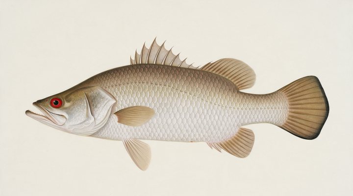
Barramundi
Excellent
Dawn, dusk and the run-off drains and creek mouths on the falling tide; hardbodies and soft vibes cast tight to snags and rock bars.
Updated Mon, 9 Nov 2026 from live weather and tide data
The East Alligator River above Cahills Crossing, on the Kakadu–Arnhem Land border: barramundi in a tidal river famous for its crocodiles, with a Bureau gauge.
Sources: Bureau of Meteorology gauge G8210015, Open-Meteo, solunar calculated for these coordinates.
East Alligator River above Cahills Crossing is a dawn-and-dusk fishery today, with the middle of the day for moving spots. The gauge reads 1.13 m, holding steady. Today brings a mixed sky, wind NNE around 13 km/h, steady pressure near 1010 hPa and a high of 38 °C. Water sits around 29 °C for the season (estimated). With the new moon, the solunar majors run 11:37 PM-1:37 AM and 11:13 AM-1:13 PM: plan around them and beat the heat.
Dawn, dusk and the run-off drains and creek mouths on the falling tide; hardbodies and soft vibes cast tight to snags and rock bars.
Tie on: Soft plastic, 3 to 5 inch paddle tail · Pilchard on ganged hooks · Metal slug, 20 to 40 g · Surface walker at first light. Prime windows: 11:37 PM-1:37 AM, 11:13 AM-1:13 PM, 5:13 AM-6:13 AM. Similar at 39 °C with likely rain: fish ahead of the front. The solunar majors shift about 50 minutes later.
Northern Territory has no general fishing licence, but rules and permits apply. Northern Territory fishing licence: cost, rules and where to buy →
Chasing barramundi here? Check the size and bag limits with NT Fisheries before you keep anything; the Barramundi page has the seasons and the tactics.
Hour-by-hour bite forecast for today from sunrise (06:03), sunset (18:40), the moon and today's score. Tap a bar to see why.
Solunar majors 11:37 PM-1:37 AM and 11:13 AM-1:13 PM; minor 5:13 AM-6:13 AM. New Moon, 0% lit.
Live readings from Bureau of Meteorology station G8210015 (East Alligator River - U/S Cahills Xng).
Bureau of Meteorology Water Data Online, station G8210015. Latest reading 2026-11-08 06:45.
Latest readings
The best day on East Alligator River above Cahills Crossing this week looks like Sunday 15 Nov, at 3 out of 5, against 2 today.
Best day this week: Sunday, 15 Nov — fair at 3/5, rising pressure behind a front, typically the slowest.
Conditions favor short windows and patient fishing.
Forecast-based scores, less reliable further out.
The species that matter on East Alligator River above Cahills Crossing: seasons written for the southern year, and how to fish each one. Today's ratings live in the report above.
The north's fish. Tidal rivers, run-off creeks, rock bars and the stocked impoundments. Warm water, moving water and a barometer on the way down. Dawn, dusk and the run-off drains and creek mouths on the falling tide; hardbodies and soft vibes cast tight to snags and rock bars.
Activity by species and month for the southern year, and how the water warms and cools. Tap any cell.
1 = slow, 5 = peak. Current month highlighted. January is midsummer here.
Typical surface temperature for this water type in degrees Celsius; today is around 29 °C (estimated, not a reading).
Real reports from real anglers, reviewed before publishing. Nothing here is copied from a shop or a charter. The water log below tracks each day automatically.
2/5 Slow. Work for them. Conditions favor short windows and patient fishing. Barramundi led the card at excellent. High of 39 °C, wind to 26 km/h.
2/5 Slow. Work for them. Conditions favor short windows and patient fishing. Barramundi led the card at excellent. High of 39 °C, wind to 19 km/h.
2/5 Slow. Work for them. Conditions favor short windows and patient fishing. Barramundi led the card at excellent. High of 39 °C, wind to 21 km/h.
Northern Territory has no general recreational fishing licence; the limits and closures do. Details and where to buy →
Size and bag limits, closed seasons and marine park zones are set by NT Fisheries and change: confirm the current rules on the agency page linked from the Northern Territory licence page before you keep anything.
The Northern Territory has no recreational fishing licence; the possession limits, the Kakadu National Park fishing rules and the Arnhem Land permit system apply, on the pages linked below..
East Alligator River above Cahills Crossing is a river in Northern Territory, Australia, covered from the Northern Territory reports and listed in all Australia waters.
Cahills Crossing is the tidal causeway where the road from Ubirr in Kakadu National Park crosses the East Alligator River into Arnhem Land. Parks Australia says saltwater crocodiles gather there in large numbers to feed on mullet and barramundi as the tide pushes over the road, and that 50 or more have been counted in the 400 metres between the crossing and the upstream boat ramp. The Bureau of Meteorology’s gauge above the crossing supplies the level of the East Alligator River above Cahills Crossing and the 30-day chart on this page. The Wildman at Runaway Camp has its own page.
Barramundi are the fish of the East Alligator, and Parks Australia calls it one of Kakadu’s standout barramundi spots; threadfin and catfish are also caught. The Northern Territory has no general closed season for barramundi, but Kakadu has its own limits: three barramundi per person, a 90 cm maximum with one fish over 90 cm per boat, and the NT-wide 55 cm minimum.
Boats launch from the ramps on either side of the crossing; Parks Australia says the upstream section is accessible all year and the downstream section is best in the run-off, February to April, when the floodplain creeks flush baitfish into the river. Rod and reel or handline only, with a single hook or lure, no live bait and no set lines. Do not cross the causeway on foot, and when fishing from land stand at least 5 metres back from the bank.
Jabiru, inside Kakadu, is the base, with fuel and supplies; check Parks Australia’s pass and access pages before you go. Arnhem Land is Aboriginal land, and entering it needs a permit from the Northern Land Council, which asks for up to 10 days to process an application. The tide runs over the causeway, so crossing depends on the tide times.
The chart shows the East Alligator’s level above the crossing, which moves with the tide there as well as with the wet; the river pages on this site carry no tide panel, so use the tide times Parks Australia links for the crossing. The water temperature estimate, labelled as one, is warm all year; pressure and sky build the score at Cahills Crossing.
The Northern Territory has no recreational fishing licence; the possession limits, the Kakadu National Park fishing rules and the Arnhem Land permit system apply, on the pages linked below.
From a boat launched at the ramps beside the crossing, or from land in the park’s designated areas, standing at least 5 metres back. Parks Australia asks visitors not to cross the causeway on foot.
Yes. Arnhem Land is Aboriginal land and the Northern Land Council issues the permit; allow up to 10 days.
No. Nobody needs a recreational fishing licence to fish the East Alligator River above Cahills Crossing, or anywhere else in the Territory.
Check the daily report at the top of this page: it is regenerated every morning from live data. Today's read: Slow. Work for them. Conditions favor short windows and patient fishing.
 Pablo Ruiz Quintero
Readings refresh on a 30-minute window. The full method, with every figure and its source, is on How our reports are made. Something wrong here? Tell us and it goes in the log with the date.