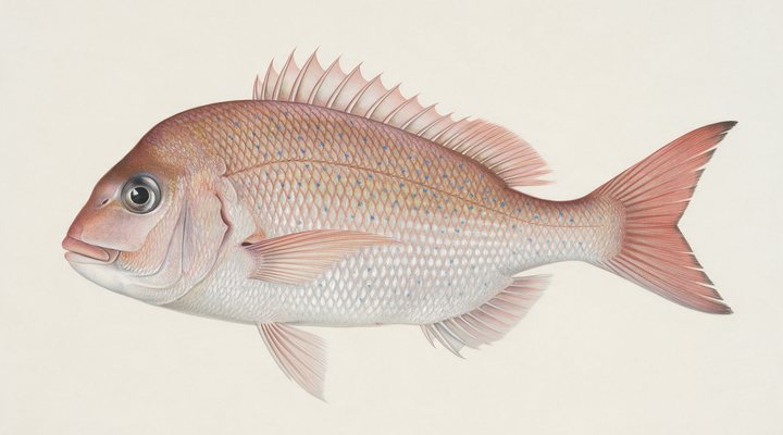
Snapper
Excellent
Fish are thinner inshore. Work the deeper structure and the channel edges with baits on the bottom, and pick the tide change.
Updated Mon, 9 Nov 2026 from live weather and tide data
Port Phillip’s wilder neighbour: tidal channels, mudflats, mangroves and the whiting, snapper and gummy shark fishery of Victoria’s second bay.
Sources: modelled tide curve, Open-Meteo, solunar calculated for these coordinates.
Western Port has cool water and fish holding a little deeper and slower. Today brings a mixed sky, wind ENE around 19 km/h, steady pressure near 1018 hPa and a high of 19 °C. Tides: high 11:46 am, low 5:41 am and 5:46 pm: the moving water either side of each change is when this place feeds. Water sits around 17 °C for the season (estimated). With the new moon, the solunar majors run 11:26 PM-1:26 AM and 11:54 AM-1:54 PM: the windows to build the day around.
Fish are thinner inshore. Work the deeper structure and the channel edges with baits on the bottom, and pick the tide change.
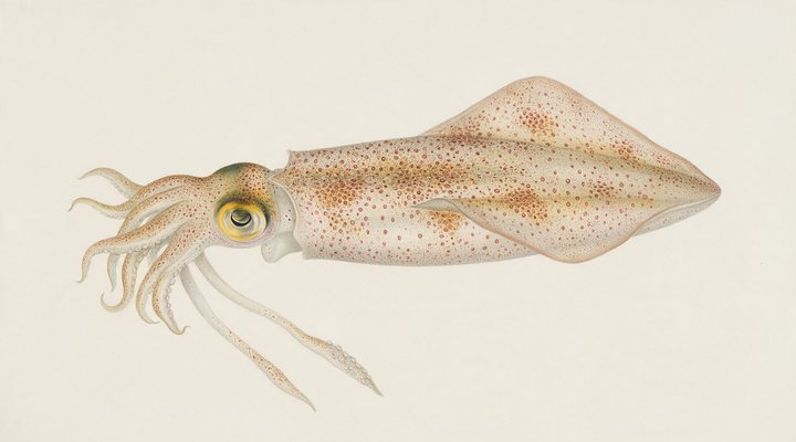
Spring and autumn are the seasons: the weed beds on the rising tide, slow sinking jigs.
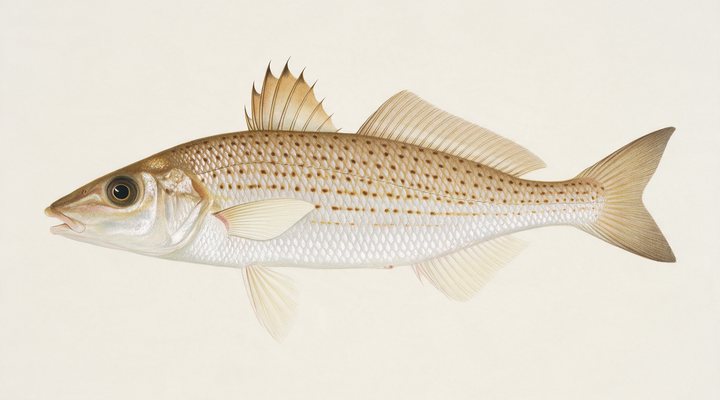
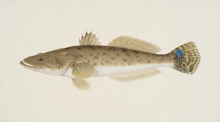
Fish the deeper channels and the last of the run-out; slower hops with a heavier jighead, and a bait on the bottom as back-up.
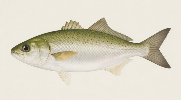
The main season. Beach gutters, rock platforms and bay edges on the rising tide; metals, surf poppers and bait all work.
Tie on: Blade or vibe, slow hops · Lightly weighted plastic · Whole pilchard or squid on the bottom · Suspending hardbody. Prime windows: 11:26 PM-1:26 AM, 11:54 AM-1:54 PM, 5:03 AM-6:03 AM. Warmer at 24 °C with a rain chance. The solunar majors shift about 50 minutes later.
Victoria requires a fishing licence for most fishing, from A$10.00. Victoria fishing licence: cost, rules and where to buy →
Chasing snapper here? Check the size and bag limits with VFA before you keep anything; the Snapper page has the seasons and the tactics.
Hour-by-hour bite forecast for today from sunrise (06:03), sunset (20:03), the moon and today's score, with the modelled tide changes in the panel below. Tap a bar to see why.
Solunar majors 11:26 PM-1:26 AM and 11:54 AM-1:54 PM; minor 5:03 AM-6:03 AM. New Moon, 0% lit.
A modelled tide curve for these coordinates and the forecast for the day.
Modelled sea level curve from Open-Meteo Marine for these coordinates, datum mean sea level. Fish the moving water either side of each change.
A model, not the official prediction: times can drift by tens of minutes inside bays and estuaries. Check the Bureau of Meteorology tide predictions for the exact times before you rely on them.
Latest readings
Why the tide matters here: tides and fishing in Australia.
The best day on Western Port this week looks like Thursday 12 Nov, at 4 out of 5, against 3 today.
Best day this week: Thursday, 12 Nov — good at 4/5, falling pressure, usually the best window of a week.
A steady pattern: dawn and dusk carry the day.
Forecast-based scores, less reliable further out.
The species that matter on Western Port: seasons written for the southern year, and how to fish each one. Today's ratings live in the report above.
The southern headline fish. Runs into Port Phillip, Western Port, the gulfs and the WA sounds in spring to spawn; holds on reef and rubble the rest of the year. Fish are thinner inshore. Work the deeper structure and the channel edges with baits on the bottom, and pick the tide change.
The table fish of the south. Feeds over sand patches between weed and reef in 2 to 10 metres, mostly by day, mostly on the moving tide. Deeper sand patches and the middle of the day; slower bites, bigger fish.
Southern calamari over weed and sand in 2 to 10 metres of the bays and gulfs; a jig fishery at dawn, dusk and under the jetty lights. Spring and autumn are the seasons: the weed beds on the rising tide, slow sinking jigs.
Not a salmon at all: a hard-fighting schooling fish of the surf and the bays, from WA around to NSW. Great on light gear, poor on the plate. The main season. Beach gutters, rock platforms and bay edges on the rising tide; metals, surf poppers and bait all work.
Dusky flathead in the eastern estuaries, sand flathead in the southern bays. An ambush predator lying on sand and mud edges waiting for whatever the tide brings. Fish the deeper channels and the last of the run-out; slower hops with a heavier jighead, and a bait on the bottom as back-up.
Activity by species and month for the southern year, and how the water warms and cools. Tap any cell.
1 = slow, 5 = peak. Current month highlighted. January is midsummer here.
Typical surface temperature for this water type in degrees Celsius; today is around 17 °C (estimated, not a reading).
Real reports from real anglers, reviewed before publishing. Nothing here is copied from a shop or a charter. The water log below tracks each day automatically.
3/5 Fair. Fish the windows. A steady pattern: dawn and dusk carry the day. Snapper led the card at excellent. High of 14 °C, wind to 31 km/h.
3/5 Fair. Fish the windows. A steady pattern: dawn and dusk carry the day. Snapper led the card at excellent. High of 13 °C, wind to 35 km/h.
3/5 Fair. Fish the windows. A steady pattern: dawn and dusk carry the day. Snapper led the card at excellent. High of 19 °C, wind to 35 km/h.
Victorian Recreational Fishing Licence (RFL), from A$10.00, the same for residents and visitors. Details and where to buy →
Size and bag limits, closed seasons and marine park zones are set by VFA and change: confirm the current rules on the agency page linked from the Victoria licence page before you keep anything.
Bring a Victorian Recreational Fishing Licence unless you are under 18, 70 or over or another VFA exemption applies; our Victoria page has the 2026/2027 prices.
Western Port is a bay or coastal water in Victoria, Australia, covered from the Victoria reports and listed in all Australia waters.
Western Port is the second of Melbourne’s two bays, east of the Mornington Peninsula and wrapped around French Island and Phillip Island, and it is nothing like Port Phillip: deep channels between wide mudflats and seagrass, mangroves on the northern shores, two entrances to Bass Strait and a tide that runs hard and drains much of the bay. The towns of Hastings, Tooradin, Corinella, Rhyll and Cowes are its ports, the channels between the islands are its fishing grounds, and the jetties and piers at Stony Point, Hastings, Cowes, Rhyll and Tooradin are its shore marks. Parks Victoria notes that the seagrass beds are nursery ground for King George whiting, bream and mullet.
King George whiting fish the seagrass and the channel edges from spring to autumn, snapper come into the channels in spring and summer, and gummy shark are a bay specialty on the channel edges through the warmer months. Australian salmon run the entrances and the Phillip Island beaches in winter, squid work the seagrass and the pier lights in spring and autumn, and flathead, garfish and silver trevally fish the piers and the shallows through the year. Bream hold in the creeks and around the mangroves of the northern shore.
Western Port is a tide fishery before it is a weather one: the tide panel, a modelled curve for these coordinates labelled as a model, shows the direction of the run, and the channels fish on the change and the run-in over the flats; the Bureau of Meteorology has the official times. The wind row matters because the bay is open and shallow, and a strong westerly or south-westerly makes the channels rough and the piers the only option. Pressure and sky build the score and the planner shows which day to take.
Bring a Victorian Recreational Fishing Licence unless you are under 18, 70 or over or another VFA exemption applies; our Victoria page has the 2026/2027 prices. The jetties are public, and the Boating Vic list has ramps at Stony Point, Hastings, Tooradin, Corinella, Rhyll, Cowes, Newhaven and Lang Lang. Western Port holds three marine national parks where all fishing is prohibited: French Island, Churchill Island south of Rhyll, and Yaringa, 776 hectares in Watsons Inlet; the VFA limits and the park boundaries are on the pages linked in the sources.
King George whiting over the seagrass, snapper in the channels in spring and summer, and gummy shark on the channel edges, all worked on the tide.
Yes. Western Port is licensed water, and the Victorian Recreational Fishing Licence is required unless you are exempt.
Check the daily report at the top of this page: it is regenerated every morning from live data. Today's read: Fair. Fish the windows. A steady pattern: dawn and dusk carry the day.
 Pablo Ruiz Quintero
Readings refresh on a 30-minute window. The full method, with every figure and its source, is on How our reports are made. Something wrong here? Tell us and it goes in the log with the date.