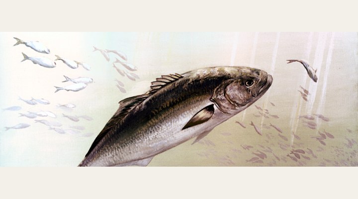
Tailor
Excellent
The main run. Fish the gutters and headlands into the evening; ganged pilchards, metals, and a wire-free trace only if you accept the bite-offs.
Updated Fri, 25 Sept 2026 from live weather and tide data
Brisbane’s bay: sand islands, shipping channels, artificial reefs and the flats where flathead, bream, whiting and snapper share a tide.
Sources: modelled tide curve, Open-Meteo, solunar calculated for these coordinates.
Moreton Bay is in its cool-water rhythm: slower presentations and the warmest hours of the day. Today brings a mixed sky, wind ESE around 13 km/h, steady pressure near 1030 hPa and a high of 23 °C. Tides: high 6:47 am and 7:02 pm, low 12:54 am and 12:51 pm: the moving water either side of each change is when this place feeds. Water sits around 18 °C for the season (estimated). With the full moon, the solunar majors run 10:25 AM-12:25 PM and 10:25 PM-12:25 AM: the windows to build the day around.
The main run. Fish the gutters and headlands into the evening; ganged pilchards, metals, and a wire-free trace only if you accept the bite-offs.
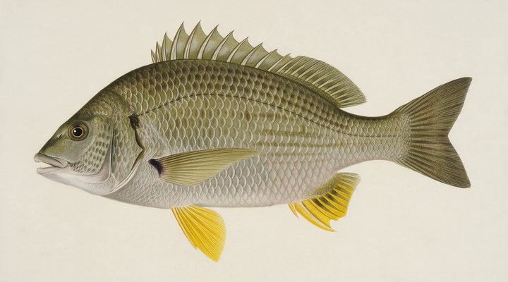
Slow the retrieve right down: blades and lightly weighted plastics along the deeper rock walls and drop-offs, or unweighted bait drifted into the snags.
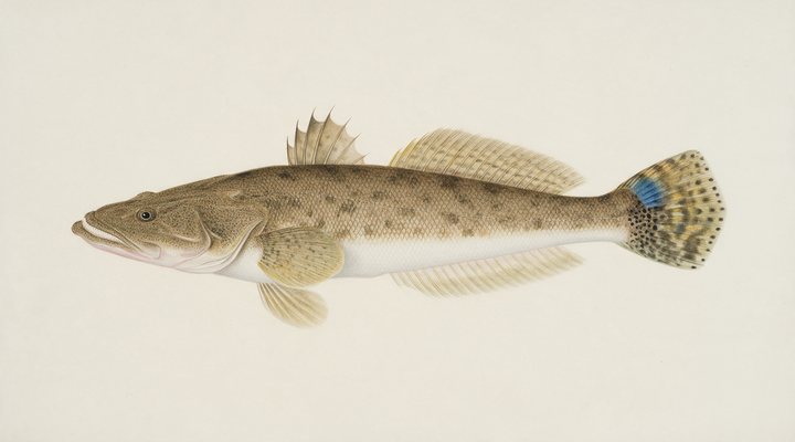
Fish the deeper channels and the last of the run-out; slower hops with a heavier jighead, and a bait on the bottom as back-up.
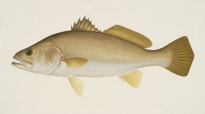
The estuary fish move to the deeper reaches. Long, quiet sessions on the bottom with fresh bait across the top of the tide.
Tie on: Blade or vibe, slow hops · Lightly weighted plastic · Whole pilchard or squid on the bottom · Suspending hardbody. Prime windows: 10:25 AM-12:25 PM, 10:25 PM-12:25 AM, 4:55 AM-5:55 AM. Similar at 22 °C with likely rain: fish ahead of the front. The solunar majors shift about 50 minutes later.
Queensland has no general fishing licence, but rules and permits apply. Queensland fishing licence: cost, rules and where to buy →
Chasing bream here? Check the size and bag limits with Queensland DPI before you keep anything; the Bream page has the seasons and the tactics.
Hour-by-hour bite forecast for today from sunrise (05:34), sunset (17:44), the moon and today's score, with the modelled tide changes in the panel below. Tap a bar to see why.
Solunar majors 10:25 AM-12:25 PM and 10:25 PM-12:25 AM; minor 4:55 AM-5:55 AM. Full Moon, 99% lit.
A modelled tide curve for these coordinates and the forecast for the day.
Modelled sea level curve from Open-Meteo Marine for these coordinates, datum mean sea level. Fish the moving water either side of each change.
A model, not the official prediction: times can drift by tens of minutes inside bays and estuaries. Check the Bureau of Meteorology tide predictions for the exact times before you rely on them.
Latest readings
Why the tide matters here: tides and fishing in Australia.
The best day on Moreton Bay this week looks like Thursday 1 Oct, at 4 out of 5, against 3 today. Every day is scored by the same engine as the report above: pressure trend first, then wind, sky and season. Pick a species and the plan for that day changes with it.
Best day this week: Thursday, 1 Oct — good at 4/5, steady pressure, neither help nor hindrance.
A steady pattern: dawn and dusk carry the day.
Scores are a planning aid built from forecast data, not a promise.
The species that matter on Moreton Bay: seasons written for the southern year, and how to fish each one. Today's ratings live in the report above.
Yellowfin bream on the east coast, black bream in the southern estuaries. Structure fish: rock walls, jetty piles, oyster racks, snags and pontoons. Slow the retrieve right down: blades and lightly weighted plastics along the deeper rock walls and drop-offs, or unweighted bait drifted into the snags.
Dusky flathead in the eastern estuaries, sand flathead in the southern bays. An ambush predator lying on sand and mud edges waiting for whatever the tide brings. Fish the deeper channels and the last of the run-out; slower hops with a heavier jighead, and a bait on the bottom as back-up.
Jewfish. The big silver prize of the estuaries, breakwalls and surf beaches: nocturnal, tide-driven and unforgiving of noise. The estuary fish move to the deeper reaches. Long, quiet sessions on the bottom with fresh bait across the top of the tide.
The surf and rock fish of the east coast, running north in autumn and winter. Fast, toothy and best at dawn, dusk and into the dark. The main run. Fish the gutters and headlands into the evening; ganged pilchards, metals, and a wire-free trace only if you accept the bite-offs.
Activity by species and month for the southern year, and how the water warms and cools. Tap any cell.
1 = slow, 5 = peak. Current month highlighted. January is midsummer here.
Typical surface temperature for this water type in degrees Celsius; today is around 18 °C (estimated, not a reading).
Real reports from real anglers, reviewed before publishing. Nothing here is copied from a shop or a charter. The water log below tracks each day automatically.
3/5 Fair. Fish the windows. A steady pattern: dawn and dusk carry the day. Tailor led the card at excellent. High of 23 °C, wind to 21 km/h.
3/5 Fair. Fish the windows. A steady pattern: dawn and dusk carry the day. Tailor led the card at excellent. High of 24 °C, wind to 19 km/h.
3/5 Fair. Fish the windows. A steady pattern: dawn and dusk carry the day. Tailor led the card at excellent. High of 26 °C, wind to 24 km/h.
Queensland has no general recreational fishing licence; permits apply on some waters and the limits and closures do. Details and where to buy →
Size and bag limits, closed seasons and marine park zones are set by Queensland DPI and change: confirm the current rules on the agency page linked from the Queensland licence page before you keep anything.
Queensland has no general fishing licence; what it has is a detailed rule book, and in Moreton Bay that rule book includes the marine park zoning as well as the size and bag limits and the closed seasons, all published by the Queensland Government and linked from the sources on this page.
Moreton Bay is a bay or coastal water in Queensland, Australia, covered from the Queensland reports and listed in all Australia waters.
Moreton Bay sits between Brisbane and the ocean, closed off by Moreton and North Stradbroke islands and fed by the Brisbane, Logan and Caboolture rivers. It is shallow and sandy in the south, deeper along the shipping channels, and full of the structure that a fishing report is really about: the beacons and channel markers that hold snapper, the sand flats off Wellington Point and Cleveland that fish for whiting and flathead, the artificial reefs that the state has built up over the years, the rock walls of the Brisbane River mouth and the Redcliffe peninsula, and the western sides of the islands where the bay meets the surf. It is also a marine park with green zones where no fishing is allowed, which is the first map to look at before any other.
Snapper are the winter fish of the bay, on the deeper reefs and around the beacons from late autumn, with the bigger fish taken at night on the bottom of the tide. Flathead lie on the sand edges in the warmer months and the bream fish the rock walls and the mangroves all year, with the winter run into the river mouths. Whiting are a summer fish on the flats, tailor and school mackerel come through in their seasons, mud crabs and sand crabs are pots-and-dillies fishing, and squid work the weed and the jetty lights. On the ocean side of the islands, the surf gutters fish for tailor and dart; inside, it is a soft-plastic and bait fishery driven by the tide.
Wind is the first number on this page for a reason: the bay is open enough that a fresh south-easterly makes the boat grounds unpleasant and pushes the fish onto the lee shores, while a still morning fishes everywhere. The tide panel is a modelled curve for these coordinates, labelled as a model; the bay’s tides are strong and the flats fish on the run-in, the beacons on the change, so use the curve for direction and the Bureau of Meteorology prediction for the minute. Pressure and sky feed the score, and the seven-day planner shows the day the pattern lines up.
Queensland has no general fishing licence; what it has is a detailed rule book, and in Moreton Bay that rule book includes the marine park zoning as well as the size and bag limits and the closed seasons, all published by the Queensland Government and linked from the sources on this page. Access is from the ramps at Manly, Wynnum, Cleveland, Victoria Point, Scarborough and Redcliffe, the jetties at Wellington Point, Cleveland and Redcliffe, and the ferries to the islands for the surf beaches.
No. Queensland has no recreational fishing licence, but the marine park zoning, size and bag limits and closed seasons apply; see the Queensland licence page for what does apply.
Snapper on the reefs and beacons in winter, flathead and whiting on the flats in summer, bream on the walls and mangroves all year, tailor and school mackerel in season, plus squid and crabs.
No. They are a modelled sea-level curve for these coordinates and say so; check the Bureau of Meteorology prediction for exact times, because the bay’s tides matter.
Check the daily report at the top of this page: it is regenerated every morning from live data. Today's read: Fair. Fish the windows. A steady pattern: dawn and dusk carry the day.
 Pablo Ruiz Quintero
Readings refresh on a 30-minute window. The full method, with every figure and its source, is on How our reports are made. Something wrong here? Tell us and it goes in the log with the date.