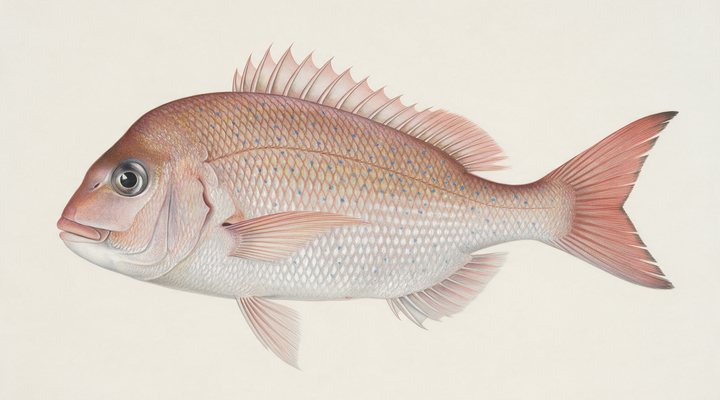
Snapper
Excellent
Fish are thinner inshore. Work the deeper structure and the channel edges with baits on the bottom, and pick the tide change.
Updated Mon, 9 Nov 2026 from live weather and tide data
The Fleurieu’s holiday town on Encounter Bay: the causeway to Granite Island, the Bluff and the beaches, and salmon in the cooler months.
Sources: modelled tide curve, Open-Meteo, solunar calculated for these coordinates.
Victor Harbor is in its cool-water rhythm: slower presentations and the warmest hours of the day. Today brings a mixed sky, wind NE around 19 km/h, steady pressure near 1011 hPa and a high of 26 °C. Tides: high 11:45 am, low 7:53 am and 4:06 pm: the moving water either side of each change is when this place feeds. Water sits around 17 °C for the season (estimated). With the new moon, the solunar majors run 11:24 PM-1:24 AM and 11:51 AM-1:51 PM: the windows to build the day around.
Fish are thinner inshore. Work the deeper structure and the channel edges with baits on the bottom, and pick the tide change.
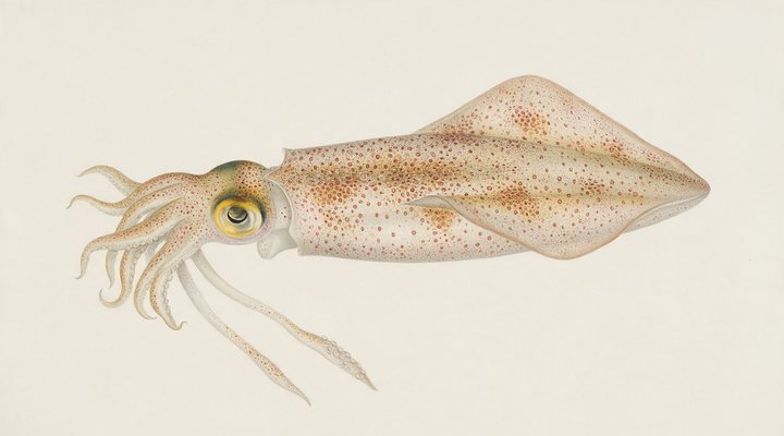
Spring and autumn are the seasons: the weed beds on the rising tide, slow sinking jigs.
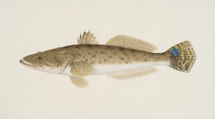
Fish the deeper channels and the last of the run-out; slower hops with a heavier jighead, and a bait on the bottom as back-up.
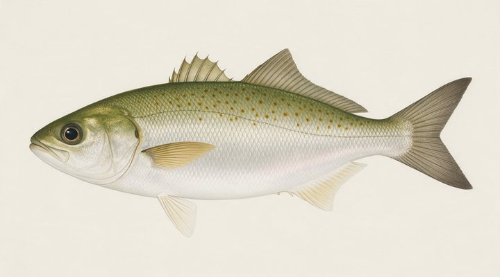
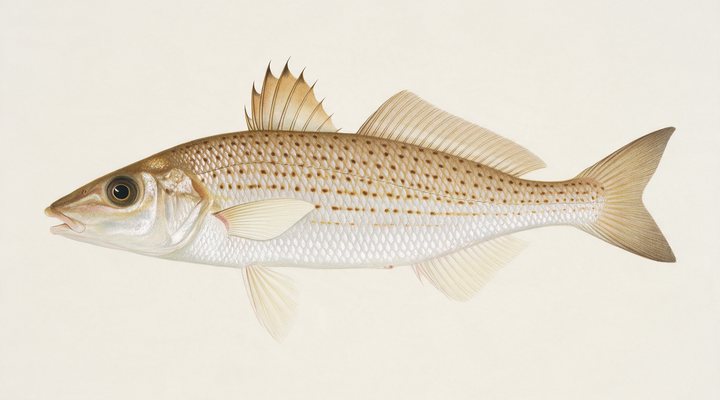
The main season. Beach gutters, rock platforms and bay edges on the rising tide; metals, surf poppers and bait all work.
Tie on: Blade or vibe, slow hops · Lightly weighted plastic · Whole pilchard or squid on the bottom · Suspending hardbody. Prime windows: 11:24 PM-1:24 AM, 11:51 AM-1:51 PM, 5:07 AM-6:07 AM. Similar at 24 °C with a rain chance. The solunar majors shift about 50 minutes later.
South Australia has no general fishing licence, but rules and permits apply. South Australia fishing licence: cost, rules and where to buy →
Chasing snapper here? Check the size and bag limits with PIRSA before you keep anything; the Snapper page has the seasons and the tactics.
Hour-by-hour bite forecast for today from sunrise (06:05), sunset (19:53), the moon and today's score, with the modelled tide changes in the panel below. Tap a bar to see why.
Solunar majors 11:24 PM-1:24 AM and 11:51 AM-1:51 PM; minor 5:07 AM-6:07 AM. New Moon, 0% lit.
A modelled tide curve for these coordinates and the forecast for the day.
Modelled sea level curve from Open-Meteo Marine for these coordinates, datum mean sea level. Fish the moving water either side of each change.
A model, not the official prediction: times can drift by tens of minutes inside bays and estuaries. Check the Bureau of Meteorology tide predictions for the exact times before you rely on them.
Latest readings
Why the tide matters here: tides and fishing in Australia.
Today is the pick of the week on Victor Harbor, at 3 out of 5.
Best day this week: today, 9 Nov — fair at 3/5, steady pressure, neither help nor hindrance.
A steady pattern: dawn and dusk carry the day.
Forecast-based scores, less reliable further out.
The species that matter on Victor Harbor: seasons written for the southern year, and how to fish each one. Today's ratings live in the report above.
Open all year This water is in the South-East fishing zone, which runs from the southern tip of the Fleurieu Peninsula to the Victorian border: the one zone where snapper may be taken until 30 June 2027, under the daily size, bag and boat limits, with every snapper reported to PIRSA Rule as read from PIRSA on 2026-09-27.
The southern headline fish. Runs into Port Phillip, Western Port, the gulfs and the WA sounds in spring to spawn; holds on reef and rubble the rest of the year. Fish are thinner inshore. Work the deeper structure and the channel edges with baits on the bottom, and pick the tide change.
The table fish of the south. Feeds over sand patches between weed and reef in 2 to 10 metres, mostly by day, mostly on the moving tide. Deeper sand patches and the middle of the day; slower bites, bigger fish.
Southern calamari over weed and sand in 2 to 10 metres of the bays and gulfs; a jig fishery at dawn, dusk and under the jetty lights. Spring and autumn are the seasons: the weed beds on the rising tide, slow sinking jigs.
Not a salmon at all: a hard-fighting schooling fish of the surf and the bays, from WA around to NSW. Great on light gear, poor on the plate. The main season. Beach gutters, rock platforms and bay edges on the rising tide; metals, surf poppers and bait all work.
Dusky flathead in the eastern estuaries, sand flathead in the southern bays. An ambush predator lying on sand and mud edges waiting for whatever the tide brings. Fish the deeper channels and the last of the run-out; slower hops with a heavier jighead, and a bait on the bottom as back-up.
Activity by species and month for the southern year, and how the water warms and cools. Tap any cell.
1 = slow, 5 = peak. Current month highlighted. January is midsummer here.
Typical surface temperature for this water type in degrees Celsius; today is around 17 °C (estimated, not a reading).
Real reports from real anglers, reviewed before publishing. Nothing here is copied from a shop or a charter. The water log below tracks each day automatically.
3/5 Fair. Fish the windows. A steady pattern: dawn and dusk carry the day. Snapper led the card at excellent. High of 17 °C, wind to 23 km/h.
3/5 Fair. Fish the windows. A steady pattern: dawn and dusk carry the day. Snapper led the card at excellent. High of 14 °C, wind to 26 km/h.
3/5 Fair. Fish the windows. A steady pattern: dawn and dusk carry the day. Snapper led the card at excellent. High of 21 °C, wind to 24 km/h.
South Australia has no general recreational fishing licence; the limits and closures do. Details and where to buy →
Size and bag limits, closed seasons and marine park zones are set by PIRSA and change: confirm the current rules on the agency page linked from the South Australia licence page before you keep anything.
No fishing licence is sold in South Australia; PIRSA publishes the size, bag and boat limits and the zone closures, and marine park sanctuary zones are closed to all fishing, with maps from the National Parks and Wildlife Service.
Victor Harbor is a coastal town in South Australia, Australia, covered from the South Australia reports and listed in all Australia waters.
Victor Harbor is the town of the southern Fleurieu Peninsula on Encounter Bay, with the causeway to Granite Island, the Bluff at Rosetta Head, the beaches running east to Port Elliot and Middleton, and the Hindmarsh and Inman rivers entering the bay. It is a Southern Ocean bay with some shelter from the island and the Bluff, fished from the causeway, the beaches and the rocks and from boats over the reefs and the sand. Encounter Bay lies east of the southern tip of the Fleurieu, near the line that separates PIRSA’s Gulf St Vincent and Kangaroo Island fishing zone from the South-East zone, and which zone a species falls under decides several of the rules below. This page scores Victor Harbor’s own position on the bay.
Australian salmon run the beaches and the Bluff in the cooler months and are the fish the southern Fleurieu is known for in winter; King George whiting feed over the sand and weed of the bay from spring to autumn; and tommy ruff and mullet are everyday fish from the causeway. Flathead and gummy shark take baits on the sand, and the Bluff and the rocks give salmon and sweep to rock anglers who watch the swell. For snapper, southern calamari and southern garfish the zone matters: all three are closed in the gulf zones, snapper until 30 June 2027 and the other two since 1 May 2026, while the South-East zone is the only one where snapper may be taken, with every fish reported to PIRSA. Check PIRSA’s zone map before keeping any of them here.
This is Southern Ocean coast and the swell decides the day: a south-westerly pushes it into the bay and closes the rocks and the beaches, while a northerly flattens the bay and makes the causeway and the beaches fishable. In Encounter Bay the barometer and the cloud cover complete the score, and the planner finds the gaps between swells. The tide panel is a modelled curve for Encounter Bay, labelled as a model; tides on this coast are irregular, so use it for the direction and the Bureau of Meteorology for the times.
No fishing licence is sold in South Australia; PIRSA publishes the size, bag and boat limits and the zone closures, and marine park sanctuary zones are closed to all fishing, with maps from the National Parks and Wildlife Service. The causeway, the beaches and the Bluff are public, with boat ramps in the town; the Bluff is exposed, and a lifejacket is the sensible choice on its rocks.
That depends on the PIRSA fishing zone: both are closed in the Gulf St Vincent and Kangaroo Island zone, while snapper may be taken, and must be reported, in the South-East zone. Check PIRSA’s zone map for Encounter Bay first.
Tommy ruff and mullet through the year, King George whiting in season and salmon in the cooler months.
Check the daily report at the top of this page: it is regenerated every morning from live data. Today's read: Fair. Fish the windows. A steady pattern: dawn and dusk carry the day.
 Pablo Ruiz Quintero
Readings refresh on a 30-minute window. The full method, with every figure and its source, is on How our reports are made. Something wrong here? Tell us and it goes in the log with the date.