Atchafalaya Basin Fishing Report

Updated Fri, Oct 23, 2026 from live gauge and weather data

The Atchafalaya Basin: the river swamp below Simmesport where Louisiana set new bass and crappie limits for the lower basin on August 1, 2026.

3/5
Fair. Fish the windows.A steady pattern: dawn and dusk carry the day.
Gauge
4.57 ft
Air / High
86 / 86 F
Wind
NE 5 mph

Sources: USGS gauge 07381515, Open-Meteo, solunar calculated for these coordinates.

Satellite view
Friday
23
October 2026

Today's Fishing Report

Generated this morning from live readings: gauge, weather model, sun and moon. A fresh report is published here every morning.

3/5Fair. Fish the windows.A steady pattern: dawn and dusk carry the day.

Atchafalaya Basin offers the kind of conditions this water was made for. The gauge reads 4.57 ft, easing 0.58 over the week. Today brings clear skies, wind NE around 5 mph, steady pressure near 1018 hPa and a high of 86. Water sits around 74 F for the season (estimated). With the waxing gibbous, the solunar majors run 9:43 AM-11:43 AM and 10:10 PM-12:10 AM: the windows to build the day around.

The plan, species by species
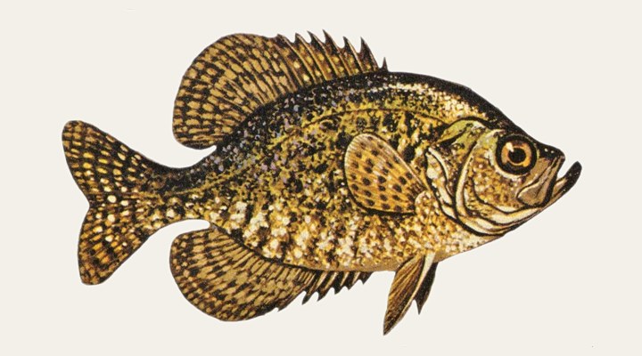
CrappieFair

Early in this band crappie are spawning in protected coves; afterward they move to docks, brush piles and standing timber near deeper water.

Tomorrow: Similar at 83 F. The solunar majors shift about 50 minutes later.Next report: Sat, Oct 24, 6:30 AMHow this report is made β†’

Before you go

Louisiana requires a fishing licence from age 18, from $17.00 for residents. What a Louisiana licence costs and where to buy it β†’

Chasing crappie here? Check the size and bag limits with LDWF before you keep anything. The season dates for Louisiana, read off the agency, are on the Louisiana seasons page.

Water and weather

Live readings from Atchafalaya River at Butte La Rose.

Gauge height, last 30 days

USGS gauge 07381515.

3.894.615.334.57 ft09/2310/0310/1310/23

Right now

Latest readings

Air temp86 F
High / Low86 / 53 F
WindNE 5-7 mph
Pressure1018.3 hPa, steady
Sky / Rain0% cloud, 0%
Sunrise / Sunset07:13 / 18:27
MoonWaxing Gibbous, 91%
Water temp (seasonal)~74 F est.

Bite planner

Hour-by-hour bite forecast for today. Tap a bar to see why.

5 AM8 AM11 AM2 PM5 PM8 PMsunrisesunsetPRIMEPRIME

Which day to fish Atchafalaya Basin this week

The best day on Atchafalaya Basin this week looks like Sunday Oct 25, at 4 out of 5, against 3 today.

Best day this week: Sunday, Oct 25 β€” good at 4/5, steady pressure, neither help nor hindrance.

Today, Oct 23 β€” Fair

A steady pattern: dawn and dusk carry the day.

Solunar majors
9:43 AM-11:43 AM and 10:10 PM-12:10 AM
Minor period
4:05 AM-5:05 AM
Sun
07:13 to 18:27
Moon
Waxing Gibbous, 91% lit
Sky and wind
Partly cloudy, 6 mph
Rain chance
0%

Forecast-based scores, less reliable further out: how the score is built.

Species guide

The species that matter on Atchafalaya Basin: seasons, structure and how to fish each one. Today's ratings live in the report above.

Crappie illustration

Crappie

Best: the spring spawn; summer around docks, brush and the thermocline

Two slab-sided panfish, the white crappie and the black crappie, that gather around submerged timber, brush piles, docks and bridge pilings in lakes, reservoirs and slow river backwaters. Texas Parks and Wildlife counts crappie as the state's most popular panfish. Early in this band crappie are spawning in protected coves; afterward they move to docks, brush piles and standing timber near deeper water.

When to come: the Atchafalaya Basin calendar

Activity by species and month, and how the water warms through the year. Tap any cell.

Species activity by month

1 = slow, 5 = peak. Current month highlighted.

J
F
M
A
M
J
J
A
S
O
N
D
Crappie
SlowPeak

Water temperature through the year

Typical surface temperature for this water type; today is around 74 F (estimated, not a reading).

5060708090JanMarMayJulSepNovOct, ~74 F now

Angler reports

Real reports from real anglers, reviewed before publishing. The water log below tracks each day automatically.

No angler reports yet this weekBe the first: your report helps every angler who checks Atchafalaya Basin today, and we feature the best catch of the week.

Water log, last days

Auto-logged from live data
Thu, Oct 22

4/5 Good. Solid day ahead. Stable-to-falling pressure and workable wind line things up. Crappie led the card at good. High of 86 F, wind to 6 mph.

Wed, Oct 21

3/5 Fair. Fish the windows. A steady pattern: dawn and dusk carry the day. Crappie led the card at fair. High of 82 F, wind to 6 mph.

Tue, Oct 20

4/5 Good. Solid day ahead. Stable-to-falling pressure and workable wind line things up. Crappie led the card at good. High of 81 F, wind to 9 mph.

Where roughly, what depth, what bait. Skip anything you want to keep secret.
Only used if we need to ask you about your report. No mailing list, no spam.

Before you go

License

Louisiana requires a valid fishing license for adults. Buy online from the state agency; one-day options exist for visitors.

Regulations

Louisiana freshwater limits (LDWF, updated Oct. 5, 2026). Lower Atchafalaya Basin and associated waters, from Aug. 1, 2026: black bass 12-in. minimum, 5 a day; crappie 8-in. minimum, 25 a day. Possession limit is twice the daily limit unless stated otherwise. Outside that area, statewide limits apply.

Access

Public launches listed by LDWF include Butte La Rose, Whiskey Bay, Bayou Sorrel, Bayou Pigeon, Bayou Benoit, Catahoula and Charenton; Sherburne WMA campground; Corps Indian Bayou area; Attakapas WMA (boat-in campgrounds) and Atchafalaya Delta WMA (boat only).

About this water

A river overflow basin of about 833,000 acres (LDWF) to almost one million acres (Atchafalaya National Heritage Area) running 140 miles from near Simmesport to the Gulf, south-central Louisiana.

Fishing Atchafalaya Basin: the full guide

The nation's largest river swamp

The Atchafalaya National Heritage Area calls the basin the nation's largest river swamp: almost a million acres of bottomland hardwoods, swamps, bayous and backwater lakes that begin near Simmesport and stretch 140 miles south to the Gulf. LDWF's management plan puts the overflow basin at 833,000 acres of land, swamp and water, receiving 30 percent of the combined flow of the Red and Mississippi rivers. The Heritage Area counts more than 100 species of fish and aquatic life in the basin.

Water levels drive everything

LDWF's fisheries staff use the USGS gauge on the Atchafalaya River at Butte La Rose (07381515) as their primary reference; the plan records a crest of 27.28 feet there in May 1973 and a low of 0.33 feet in October 1976. The gauge on this page, at Simmesport, sits where the basin begins. LDWF also documents repeated fish kills from low dissolved oxygen after hurricanes and heavy rains, and estimates about 50,000 acres of aquatic plant cover, with water hyacinth a long-standing problem.

New rules in the lower basin

From August 1, 2026, black bass (largemouth and spotted) in the Lower Atchafalaya Basin, Grassy Lake, Lake Palourde, Lake Verrett and associated waterbodies carry a 12-inch minimum and a daily limit of 5, down from the statewide 10 with no length limit. Crappie in the same area now have an 8-inch minimum and a daily limit of 25 instead of 50. LDWF defines the area by levees and highways: south of US 190, east of the West Atchafalaya Basin Protection Levee, north of US 90 and west of LA 1 and LA 20.

Launches and public lands

LDWF's plan lists public launches including Bayou Benoit, Catahoula, Butte La Rose, Whiskey Bay, Ramah, Bayou Pigeon, Bayou Sorrel, Belle River and Charenton. Sherburne Wildlife Management Area, which includes the Atchafalaya National Wildlife Refuge, has a campground near Krotz Springs; the Corps runs the Indian Bayou area near Henderson Lake; Attakapas WMA in the lower basin has two boat-in campgrounds, and the Atchafalaya Delta WMA, about 25 miles south of Morgan City, is reachable only by boat.

Common questions

What are the bass limits in the Atchafalaya Basin?

In the Lower Atchafalaya Basin and associated waters, from August 1, 2026: a 12-inch minimum and 5 a day. Elsewhere in Louisiana the statewide rule is 10 a day with no length limit, unless a water has its own rule.

Which gauge should I watch?

LDWF's fisheries staff use the USGS gauge at Butte La Rose (07381515). The Simmesport gauge on this page shows the river where it enters the basin.

Where can I launch?

LDWF lists public launches across the basin, among them Butte La Rose, Whiskey Bay, Bayou Sorrel, Bayou Pigeon, Bayou Benoit and Catahoula.

Is fishing good at Atchafalaya Basin right now?

Check the daily report at the top of this page: it is regenerated every morning from live data. Today's read: Fair. Fish the windows. A steady pattern: dawn and dusk carry the day.

Nearby waters

Where this page's numbers come from

River and reservoir readings
USGS 07381515 β€” Atchafalaya River at Butte La Rose
Read from the USGS Water Data API (api.waterdata.usgs.gov). Latest value timestamped 2026-10-23 at 19:00 UTC.
Weather and pressure
Open-Meteo forecast model
Queried at 30.1500, -91.6000 in this water's own timezone. A model, not an observation.
Moon and solunar windows
Calculated on this site
Astronomical calculation from these coordinates and the date, not a third-party feed. How much weight it deserves.
Pages checked
The facts in the written guide were checked against these pages, from the agencies and operators that manage the water, on October 7, 2026. Anything we could not verify was taken out.
The written guide on this page
Pablo Ruiz Quintero
How this page was made. The daily report is computed by our scoring engine from live readings; nobody types it. The written text was drafted with AI assistance from the official pages listed above, and its facts were checked against those pages by automated verification on October 7, 2026; anything that could not be verified was taken out. Pablo Ruiz Quintero sets every guideline, the data-verification system and the minimum standards a page must meet to be published, reviews page structure and approves what goes live; the responsibility is his, and the AI carries out the work. We work this way because it is how one person can keep every page current with named sources. Errors are published in the verification log; the full policy is in the editorial policy.

Readings refresh on a 30-minute window. The full method, with every figure and its source, is on how our reports are made. Something wrong here? Tell us and it goes in the log with the date.