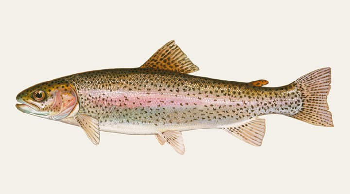
Rainbow trout
Excellent
Prime. Shore fishing along the edges with bait, spinners and flies, and the rivers if the season is open.
Updated Mon, 9 Nov 2026 from live weather and tide data
The Derwent’s headwater storage behind Clark Dam at Butlers Gorge: plentiful small brown trout, some rainbows, open all year, with a Bureau gauge at the dam.
Sources: Bureau of Meteorology gauge 128.1, Open-Meteo, solunar calculated for these coordinates.
Lake King William has cool water and fish holding a little deeper and slower. The gauge reads 718.53 m, easing 0.11 over the week. Today brings a mixed sky, wind W around 5 km/h, steady pressure near 1019 hPa and a high of 16 °C. Water sits around 13 °C for the season (estimated). With the new moon, the solunar majors run 11:21 PM-1:21 AM and 11:50 AM-1:50 PM: the windows to build the day around.
Prime. Shore fishing along the edges with bait, spinners and flies, and the rivers if the season is open.
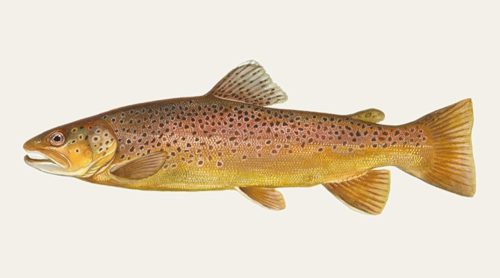
Prime. Nymphs and streamers on the rivers, and the lake edges on the overcast days.
Tie on: Blade or vibe, slow hops · Lightly weighted plastic · Whole pilchard or squid on the bottom · Suspending hardbody. Prime windows: 11:21 PM-1:21 AM, 11:50 AM-1:50 PM, 4:49 AM-5:49 AM. Similar at 14 °C with likely rain: fish ahead of the front. The solunar majors shift about 50 minutes later.
Tasmania requires a fishing licence for most fishing, from A$29.00. Tasmania fishing licence: cost, rules and where to buy →
Chasing rainbow trout here? Check the size and bag limits with IFS Tasmania before you keep anything; the Rainbow trout page has the seasons and the tactics.
Hour-by-hour bite forecast for today from sunrise (05:50), sunset (20:07), the moon and today's score. Tap a bar to see why.
Solunar majors 11:21 PM-1:21 AM and 11:50 AM-1:50 PM; minor 4:49 AM-5:49 AM. New Moon, 0% lit.
Live readings from Bureau of Meteorology station 128.1 (KING WILLIAM LAKE - AT DAM).
Bureau of Meteorology Water Data Online, station 128.1. Latest reading 2026-11-08 00:00.
Latest readings
The best day on Lake King William this week looks like Thursday 12 Nov, at 4 out of 5, against 3 today.
Best day this week: Thursday, 12 Nov — good at 4/5, falling pressure, usually the best window of a week.
A steady pattern: dawn and dusk carry the day.
Forecast-based scores, less reliable further out.
The species that matter on Lake King William: seasons written for the southern year, and how to fish each one. Today's ratings live in the report above.
Open all year Lake King William is open all year Rule as read from Inland Fisheries Service Tasmania on 2026-09-23.
The stocked lakes of the Snowy Mountains, the Victorian highlands and the Tasmanian central plateau. Closed seasons apply on the rivers: check the state rules. Prime. Shore fishing along the edges with bait, spinners and flies, and the rivers if the season is open.
Open all year Lake King William is open all year Rule as read from Inland Fisheries Service Tasmania on 2026-09-23.
The wild trout of the highland rivers and Tasmania's lakes. Spawns in autumn, hence the closed rivers through winter in NSW and Victoria. Prime. Nymphs and streamers on the rivers, and the lake edges on the overcast days.
Activity by species and month for the southern year, and how the water warms and cools. Tap any cell.
1 = slow, 5 = peak. Current month highlighted. January is midsummer here.
Typical surface temperature for this water type in degrees Celsius; today is around 13 °C (estimated, not a reading).
Real reports from real anglers, reviewed before publishing. Nothing here is copied from a shop or a charter. The water log below tracks each day automatically.
3/5 Fair. Fish the windows. A steady pattern: dawn and dusk carry the day. Rainbow trout led the card at excellent. High of 12 °C, wind to 13 km/h.
3/5 Fair. Fish the windows. A steady pattern: dawn and dusk carry the day. Rainbow trout led the card at excellent. High of 4 °C, wind to 19 km/h.
3/5 Fair. Fish the windows. A steady pattern: dawn and dusk carry the day. Rainbow trout led the card at excellent. High of 9 °C, wind to 26 km/h.
Tasmanian Inland Angling Licence, from A$29.00, the same for residents and visitors. Details and where to buy →
Size and bag limits, closed seasons and marine park zones are set by IFS Tasmania and change: confirm the current rules on the agency page linked from the Tasmania licence page before you keep anything.
From age 14 an inland angling licence is required in Tasmania; the fees are listed on our Tasmania licence page.
Compare it with every other storage in the state on Tasmania dam levels today.
Lake King William is a lake in Tasmania, Australia, covered from the Tasmania reports and listed in all Australia waters.
Hydro Tasmania created Lake King William in 1950 with the 70-metre Clark Dam across the Derwent River, and a further 6 metres was added to the wall in the late 1960s, the Inland Fisheries Service records. The lake is heavily drawn on for electricity generation and its level swings widely through the year. Butlers Gorge is about two hours from Hobart on the A10. The level and 30-day chart below are read from the Bureau of Meteorology’s gauge at Clark Dam.
Brown trout were in the system before the dam, and 100,000 yearling rainbows went in when the lake filled, with more rainbow stockings through the early 1950s; even so, brown trout dominate the catch. The many creeks and rivers flowing in give endless spawning water, which has produced a large population of small trout. King William is open all year and managed as a Premium Wild Trout Fishery, with bait, lure and fly allowed, a 220 mm minimum and a bag of 20; the species card reads open all year with the rule linked.
Trolling is a reliable way to take good bags of mostly brown trout, the service says, and spinning and bait fishing are productive at times. The northern end of the lake and the Guelph basin are the best areas, with evening dry-fly activity in the north-west corner and in the Guelph basin. The water is clear enough to polaroid along the steeper shores, and loch-style drifts with two or three flies work well.
Because the lake is drawn on so heavily for generation, the level chart is one of the most useful things on this page: launching and shore access both change with it. The water temperature estimate, labelled as one, stays cold for much of the year at this altitude. Read the wind row before crossing open water; pressure and sky complete the score.
From age 14 an inland angling licence is required in Tasmania; the fees are listed on our Tasmania licence page. The large ramp at Butlers Gorge in the south is usable at most levels, while the launching areas at the northern end off the Lyell Highway are not always usable. Boats must keep out of the water bounded by Clark Dam and the signs about 300 metres upstream on the western bank and 100 metres upstream on the eastern bank. The Inland Fishing Code and the service’s page for King William sit in the sources.
All year: the Inland Fisheries Service lists it among the waters open all year, and the species card shows it with the rule linked.
At the large ramp at Butlers Gorge at the southern end, usable at most water levels; the northern launching areas off the Lyell Highway depend on the lake level.
Check the daily report at the top of this page: it is regenerated every morning from live data. Today's read: Fair. Fish the windows. A steady pattern: dawn and dusk carry the day.
 Pablo Ruiz Quintero
Readings refresh on a 30-minute window. The full method, with every figure and its source, is on How our reports are made. Something wrong here? Tell us and it goes in the log with the date.