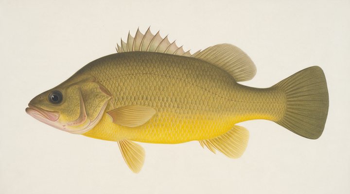
Golden perch
Excellent
Prime. Hop soft plastics and vibes around the timber, or fish shrimp and worms on the bottom.
Updated Mon, 9 Nov 2026 from live weather and tide data
The Manilla River storage upstream of Manilla: golden perch, cod, silver perch and catfish in a lake that shrinks in dry years, with the Bureau’s gauge at the wall.
Sources: Bureau of Meteorology gauge 419080, Open-Meteo, solunar calculated for these coordinates.
Split Rock Dam sits in the warm band: moving baits, moving tides and fish on the edges. The gauge reads 446.15 m, easing 0.06 over the week. Today brings clear skies, wind SSE around 2 km/h, rising pressure near 1017 hPa and a high of 21 °C. Water sits around 19 °C for the season (estimated). With the new moon, the solunar majors run 11:55 PM-1:55 AM and 11:31 AM-1:31 PM: the windows to build the day around.
Prime. Hop soft plastics and vibes around the timber, or fish shrimp and worms on the bottom.
Reopens 1 Dec 2026. Closed 1 September to 30 November in all waters except Blowering and Copeton dams.
Tie on: Soft plastic on a 1/4 oz jighead · Small hardbody, shallow diver · Squid jig, size 3.0 · Fresh pipi or worm on a small hook. Prime windows: 11:55 PM-1:55 AM, 11:31 AM-1:31 PM, 4:59 AM-5:59 AM. Warmer at 26 °C. The solunar majors shift about 50 minutes later.
New South Wales requires a fishing licence for most fishing, from A$7.00. New South Wales fishing licence: cost, rules and where to buy →
Chasing murray cod here? Check the size and bag limits with DPIRD NSW before you keep anything; the Murray cod page has the seasons and the tactics.
Hour-by-hour bite forecast for today from sunrise (05:56), sunset (19:26), the moon and today's score. Tap a bar to see why.
Solunar majors 11:55 PM-1:55 AM and 11:31 AM-1:31 PM; minor 4:59 AM-5:59 AM. New Moon, 0% lit.
Live readings from Bureau of Meteorology station 419080 (SPLIT ROCK DAM).
Bureau of Meteorology Water Data Online, station 419080. Latest reading 2026-11-07 23:00.
Latest readings
The best day on Split Rock Dam this week looks like Tuesday 10 Nov, at 4 out of 5, against 2 today.
Best day this week: Tuesday, 10 Nov — good at 4/5, rising pressure behind a front, typically the slowest.
Conditions favor short windows and patient fishing.
Forecast-based scores, less reliable further out.
The species that matter on Split Rock Dam: seasons written for the southern year, and how to fish each one. Today's ratings live in the report above.
Closed now Reopens 1 Dec 2026. Closed 1 September to 30 November in all waters except Blowering and Copeton dams. Rule as read from DPIRD NSW on 2026-09-23.
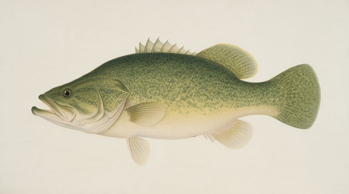
The giant of the inland rivers and the big lakes (Hume, Mulwala, Eildon). A snag fish that eats big lures, and a species with a closed season across the Murray-Darling.
Yellowbelly. The bread-and-butter native of the Murray-Darling lakes and rivers; loves warm water, structure and a lure worked slowly past its nose. Prime. Hop soft plastics and vibes around the timber, or fish shrimp and worms on the bottom.
Activity by species and month for the southern year, and how the water warms and cools. Tap any cell.
1 = slow, 5 = peak. Current month highlighted. January is midsummer here.
Typical surface temperature for this water type in degrees Celsius; today is around 19 °C (estimated, not a reading).
Real reports from real anglers, reviewed before publishing. Nothing here is copied from a shop or a charter. The water log below tracks each day automatically.
2/5 Slow. Work for them. Conditions favor short windows and patient fishing. Golden perch led the card at excellent. High of 19 °C, wind to 19 km/h.
4/5 Good. Solid day ahead. Stable-to-falling pressure and workable wind line things up. Golden perch led the card at excellent. High of 27 °C, wind to 18 km/h.
4/5 Good. Solid day ahead. Stable-to-falling pressure and workable wind line things up. Golden perch led the card at excellent. High of 26 °C, wind to 13 km/h.
NSW Recreational Fishing Fee, from A$7.00, the same for residents and visitors. Details and where to buy →
Size and bag limits, closed seasons and marine park zones are set by DPIRD NSW and change: confirm the current rules on the agency page linked from the New South Wales licence page before you keep anything.
Split Rock needs the NSW Recreational Fishing Fee, from A$7 for three days, as the New South Wales licence page sets out.
Compare it with every other storage in the state on New South Wales dam levels today.
Split Rock Dam is a lake in New South Wales, Australia, covered from the New South Wales reports and listed in all Australia waters.
Split Rock Dam sits on the Manilla River about 28 kilometres upstream of Manilla and 70 kilometres north-west of Tamworth. WaterNSW lists it at 394 gigalitres and 22 square kilometres and describes it as the third dam built in the Namoi Valley, run with Keepit Dam downstream for irrigation, environmental flows and town water. Its level is the story of every season, falling hard in the dry years, and the Bureau of Meteorology’s gauge at the dam is where the reading and the 30-day chart on this page come from.
WaterNSW names Murray cod, golden perch and silver perch as the top catches, with catfish and carp also caught, and DPIRD’s stocking plan shows golden perch and cod released in 2025/26. Golden perch are the mainstay on the points and the timber from spring to autumn; cod are closed from 1 September to 30 November under the rule the species card computes; and Split Rock is on DPIRD’s lists of dams where silver perch and freshwater catfish may be taken. Redfin are present too, and carp must not be returned alive. When the lake is low the fish are concentrated, and the fishing can be good if the ramp still reaches the water.
Read the chart before anything: a lake at a few per cent is a different water from a full one, and the ramps and the shore camping move with it. The wind row matters on the open basin, the water temperature estimate, marked as an estimate, sets the perch band, and the pressure row helps for the cod in summer. The planner then ranks the week at Split Rock.
Split Rock needs the NSW Recreational Fishing Fee, from A$7 for three days, as the New South Wales licence page sets out. The main camping ground, about a kilometre north of the wall on the western foreshore, has powered and unpowered sites, a fish cleaning area and a concrete ramp; Glenriddle Reserve on the northern shore of the upper reaches has unpowered sites and a gravel ramp, and bookings go through Tamworth Regional Council’s Barraba office. There is no access to the dam wall, and WaterNSW warns that the lake cannot be reached by Crow Mountain Road, whatever some navigation apps suggest; follow Manilla Road and Split Rock Dam Road.
The main camping ground has the concrete ramp and, in a low year, the deepest water within reach; the old river channel up the middle of the basin is where the perch and the cod hold when the lake is down, and the timber and the points along the shore come into play when it fills. A boat with a sounder finds the channel, and bank anglers fish the points near the ramps.
Golden perch, Murray cod outside the closure, and silver perch and catfish, both of which may be kept here under the DPIRD impoundment rules; carp too.
From Tamworth, follow Manilla Road for about 59 kilometres past Upper Manilla and turn onto Split Rock Dam Road; WaterNSW warns that Crow Mountain Road does not reach the dam.
Check the daily report at the top of this page: it is regenerated every morning from live data. Today's read: Slow. Work for them. Conditions favor short windows and patient fishing.
 Pablo Ruiz Quintero
Readings refresh on a 30-minute window. The full method, with every figure and its source, is on How our reports are made. Something wrong here? Tell us and it goes in the log with the date.